MORRIS ISLAND
Spring: *** Summer: ** Fall: *** Winter: **
Independent Directions to this Site: From Highway 417 (The Queensway), take the Antrim exit and drive northeast 0.8 km to Antrim and Highway 17. Turn left or northwest on 17 and go 6.2 km to the Galetta Sideroad. Turn right or northeast onto it and proceed 4.2 km to Logger's Way. Turn right or northwest onto it and go 0.8 km to the bridge onto Morris Island.
Ottawa River West: Ontario Route Directions: From Chats Dam, return southward on the dirt road to the entrance to Chats Dam at the turnabout. Go straight across to the south and follow Victoria Street back around to Harbour Street. Turn right or southeast onto it and proceed 1.1 km to the Galetta Side Road. Turn right or southwest onto it and proceed 4.3 km to Logger's Way. Turn right or northwest onto it and go 0.8 km to the bridge onto Morris Island.
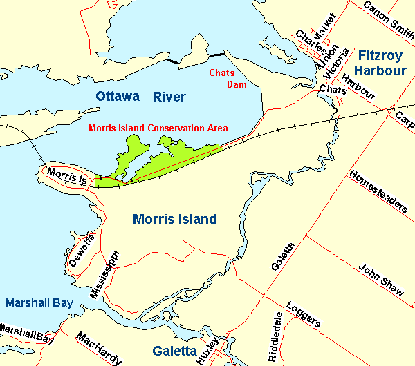 Map of Morris Island area
Site Description and Birding Information: Be sure to check along Loggers Way on your way to the island, breeding Sedge Wren (in a fen on the east side) and Golden-crowned Kinglet have been found here. Check the power line area just beyond the bridge for Red-shouldered Hawk. Follow the road as it loops around the island and passes several marshy areas.
At the end of the road, 5.0 km from the bridge, is the parking area for the Morris Island Conservation Area. There are several trails here, including one that follows the berm to Chats Dam, our previous site. On July 1, 2002, a Caspian Tern flow over the conservation area.
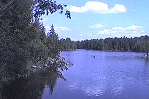
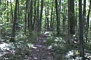 Views of Morris Island Conservation Area
Ottawa River West: Ontario Route Directions: This is the final site along this route. The fastest return route to the city is to take the Galetta Side Road to Highway 17, thence to 417. You can also backtrack to take the Woodridge - Quyon ferry to Quyon and explore the Ottawa River West - Quebec route. You could use this ferry to perform a loop back to the metropolis. The ferry only runs when the river is not frozen. Alternately, you could join the Mississippi River Valley Loop heading southwest at the MacHardy Road site or southeast at the Galetta site.
Return to Ottawa River West: Ontario.
Return to Birding Ottawa Table of Contents.
|