GALETTA
Spring: ** Summer: ** Fall: ** Winter: **
Independent Directions to this Site: From Highway 417 (The Queensway), take the Antrim exit and drive northeast 0.8 km to Antrim and Highway 17. Turn left or northwest on 17 and go 6.2 km to the Galetta Sideroad. Turn right or northeast onto it and proceed 3.5 km to the Mohrs Side Road to begin birding the Galetta area.
Mississippi River Valley Route Directions: From wherever you are on it, return southeast on MacHardy Road to its junction with the Galetta Side Road. Turn left or northeast and drive 1.4 km to the Mohrs Side Road to begin birding the Galetta area.
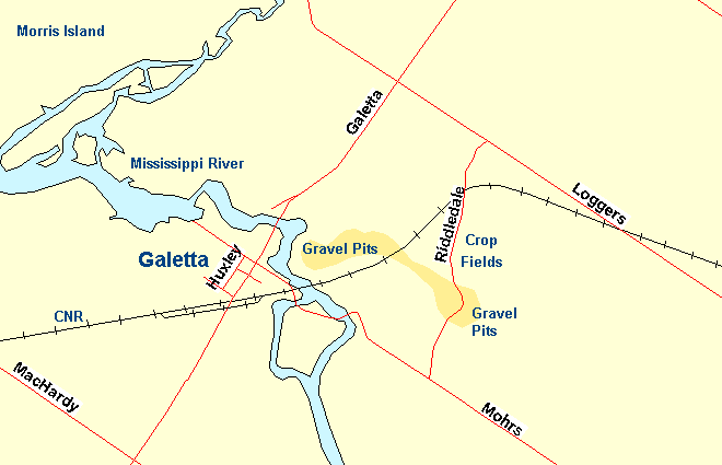 Map of the Galetta area
Site Description and Birding Information: In winter especially, check the feeders in Galetta itself, a Carolina Wren once guested there. Take Mohrs Side Road southeast 1.2 km to Riddledale Road. Along the way you will cross two bridges over the Mississippi River, transiting an island in its midst. Watch for waterfowl, swallows and field birds in season. In July 1990, 3 Loggerhead Shrikes were seen here.
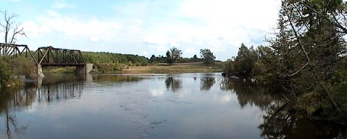 Mississippi River at Mohrs Side Road
Turn left or northeast onto Riddledale Road and drive its 1.2 km length. There is a large gravel quarry one must drive through, check for Bank Swallows in summer. Beyond the gravel pits are field crops, sometimes corn, whose stubble attract many sparrows in late fall and winter. They have a good shelterbelt of trees on the northwest side. This site ends when you reach Loggers Way.
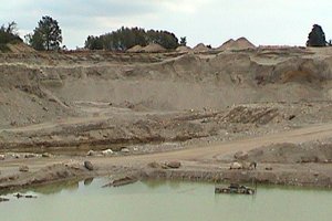 Gravel Pits along Riddledale Road
During the great invasion of 2004 - 05, several Great Gray Owls spent late December to at least late February in the Galetta area.
This site could be used as a jumping off point to join the Ottawa River West Ontario route at the Morris Island site, and trace it in reverse to Ottawa.
Mississippi River Valley Route Directions: From the junction of Loggers Way and Riddledale Road, turn right or southeast onto Loggers Way and travel 4.7 km to the northwest edge of Kinburn, where the road begins to run beside the Carp River. This is our next site, the Carp River at Kinburn.
Return to Mississippi River Valley.
Return to Birding Ottawa Table of Contents.
|