QUYON
Spring: ** Summer: * Fall: ** Winter: *
Independent Directions to this Site: From Boulevard des Allumettières or Highway 148, take the Chemin Eardley exit in Aylmer. Turn right or northwest onto Chemin Eardley or the continuation of Highway 148 and proceed 31.0 km northwest on 148 to the 2nd Quyon turnoff at Chemin Murray. Turn left or south onto Murray. Turn left or south on it and go 0.6 km to Chemin Clarendon/Mackechnie. Turn right or west and drive 0.6 km to Rue Onslow. Turn left or south on it and 0.4 km to the ferry dock at Quyon.
Ottawa River West: Quebec Route Directions: From the junction of Highway 148 and Chemin River or Chemin de la Rivière or even River Road on the Chemins Cochrane and River (de la Rivière) "site", turn left or west on 148. Proceed 2.6 km to Chemin Murray. Turn left or south on it and go 0.6 km to Chemin Clarendon/Mackechnie. Turn right or west and drive 0.6 km to Rue Onslow. Turn left or south on it and 0.4 km to the ferry dock at Quyon.
From Quyon you can also take the ferry across to Woodridge, which is between MacLaren's Landing and Fitzroy Harbour on the Ottawa River West Ontario route. This will allow you to follow that route back to the city of Ottawa. The ferry only runs when the river is not frozen.
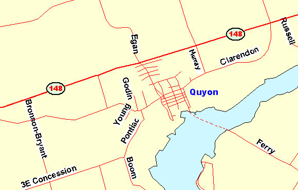 Map of Quyon area
Site Description and Birding Information: There are good views of the Ottawa River from this spot. From near the ferry dock, you can scan large portions of the river, including a spit formed by the mouth of the Quyon River east of the docks used by roosting gulls. Two adult Caspian Terns were seen here July 1, 2005, five on Jun. 24, 2009 and 2 on Jul.9, 2009; while a juvenile Western Sandpiper was seen on Sep. 30, 2007.
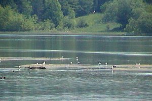 Spit East of Quyon Ferry Dock
Ottawa River West: Quebec Route Directions: From the ferry dock at Quyon, return 0.4 km along Onslow to Chemin Clarendon/Mackechnie (main street Quyon) and turn left (first of five consecutive left turns to reach the next site). Proceed west 4.6 km on Clarendon/Mackechnie to Highway 148 and turn left or west on it. Go 2.8 km to Chemin de Norway Bay (d'Aylmer) and turn left or WSW on it. Drive 6.7 km on de Norway Bay to Chemin d'Elmside and turn left or SSW on it. Follow d'Elmside 0.5 km SSW to Trudeau Lane and turn left or ESE on it just north of Norway Bay, the last site on this route.
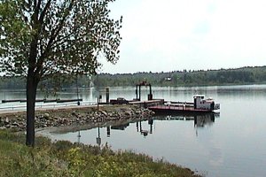 Quyon - MacLaren's Landing Ferry
Return to Ottawa River West: Quebec.
Return to Birding Ottawa Table of Contents.
|