CHATS DAM
Spring: *** Summer: ** Fall: *** Winter: *
Independent Directions to this Site: From Highway 417 (The Queensway), take the Antrim exit and drive northeast 0.8 km to Antrim and Highway 17. Turn left or northwest on 17 and go 6.2 km to the Galetta Sideroad. Turn right or northeast onto it and proceed 8.5 km to Regional Road # 5 or Harbour Street. Turn left or northwest toward Fitzroy Harbour here and go 1.1 km to Victoria Street. Turn left or southwest onto it and follow it as it curves round to the northwest to the entrance to Chats Dam. The entrance is on the right and normally gated off. However, directly across the turnabout is a dirt road (Portage Road) that leads to the base of Chats Dam.
Ottawa River West: Ontario Route Directions: From the entrance of Fitzroy Provincial Park, turn right or southeast and drive 2.0 km to Market Street, Fitzroy Harbour. Turn right or southwest onto it and proceed 1.1 km to Harbour Street. Turn left or southeast onto Harbour and go 0.5 km to Victoria Street. Turn right or southwest onto it and follow it as it curves round to the northwest to the entrance to Chats Dam. The entrance is on the right and normally gated off. However, directly across the turnabout is a dirt road (Portage Road) that leads to the base of Chats Dam.
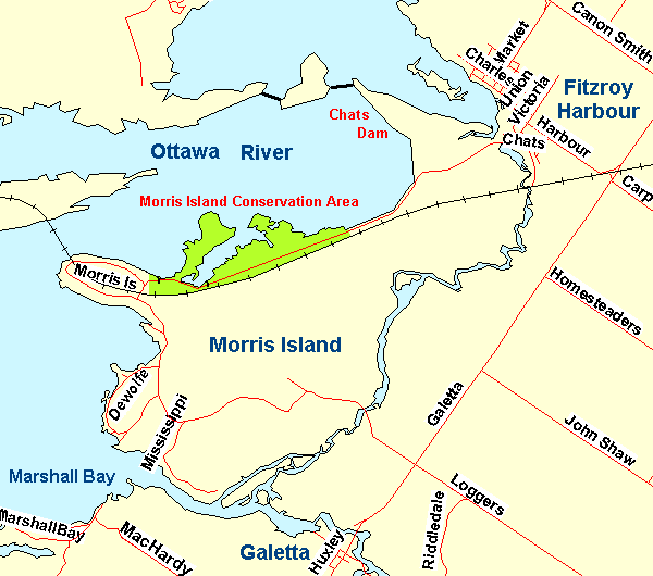 Map of Chats Dam area
Site Description and Birding Information: From the beginning of Victoria Street, look out over the fields to the south and scan the hydro pylons. One of them has had an Osprey's nest on it for many years now. It may be easier to see from Learmouth Avenue in the new Fitzroy Estates subdivision. The nearby fields can be good for sparrows in migration and Upland Sandpiper has been seen here.
The dirt road (Portage Road) to the dam is not usually open for vehicles in winter, but is passable with caution the rest of the year. At the end of the road there is a large marsh on one side and the dam berm on the other. You can actually drive up onto the berm and view the area above the dam for diving ducks, loons and grebes. You can also look down into the marsh and scan it thouroughly for puddle ducks and marsh birds. You can drive along the dyke between the river and the marsh to the far side of the marsh where the road is blocked to cars. Walking a bit farther will bring you to the eastern end of the adjacent site, Morris Island, which is many kilometres by car.
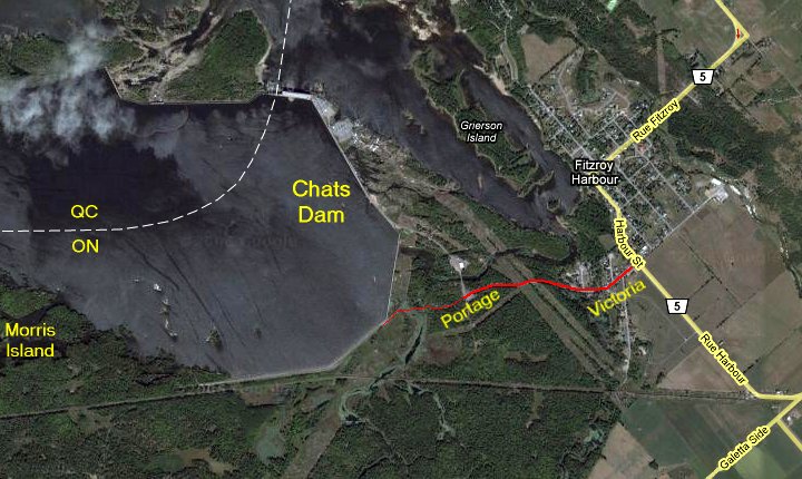 Google Satellite View of the Chats Dam Area
Ottawa River West: Ontario Route Directions: From Chats Dam, return southward on the dirt road to the entrance to Chats Dam at the turnabout. Go straight across to the south and follow Victoria Street back around to Harbour Street. Turn right or southeast onto it and proceed 1.1 km to the Galetta Side Road. Turn right or southwest onto it and proceed 4.3 km to Logger's Way. Turn right or northwest onto it and go 0.8 km to the bridge onto Morris Island, our next site.
Return to Ottawa River West: Ontario.
Return to Birding Ottawa Table of Contents.
|