AIRPORT GRAVEL PIT & COTTAGE ROAD
Spring: ** Summer: * Fall: ** Winter: **
Independent Directions to this Site: From Highway 417 (The Queensway) take exit 121A (Bronson Avenue). Go SSE on Bronson for 3.6 km, crossing the Rideau River on the Dunbar Bridge and going over Riverside Drive, before bearing right to take the Brookfield Road exit. In 0.1 km merge right onto Brookfield Road and drive 0.5 km to Riverside Drive. Turn left onto Riverside Drive and go 4.9 km to a dirt road on the right or west across from the airport runways. Turn right or west onto this road and park where you are able to pull off the side.
Rideau River East Side Route Directions: From the parking area near Revelstoke Park, return the 0.3 km to Riverside Drive. Turn right or south on it and proceed 2.4 km to a dirt road on the right or west across from the airport runways. Turn right or west onto this road and park where you are able to pull off the side.
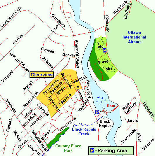 Map of the Airport Gravel Pit & Cottage Road area
Site Description and Birding Information: From where you are parked you can wander around the gravel pit area looking for finches and sparrows or walk down the road through the woods to a strip of "cottages" along the Rideau River checking for thrushes, Ovenbird, Ruffed Grouse and winter finches. Check the airport grounds for grassland birds such as American Golden-Plover. Northern Shrike has been seen south of the bridge on Hunt Club Road.
This site is also the first site in the Airport Loop. Here you might wish to veer off on the Airport Loop rather than continue south on the Rideau River East Side tour. To do so, go to the next site on Airport Loop, Tom Roberts Avenue.
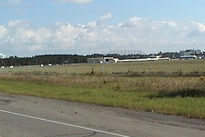 View of Airport from this Site
Rideau River East Side Route Directions: From where you have parked along the dirt road, return to Riverside Drive. Turn right or south on it and proceed 1.1 km to where it becomes River Road. Then continue straight or south along River for an additional 2.9 km to the Mosquito Creek bridge, 0.2 km north of Leitrim Road. This is the beginning of the next site on this route, the Mosquito Creek area.
Return to Rideau River East Side.
Return to Birding Ottawa Table of Contents.
|