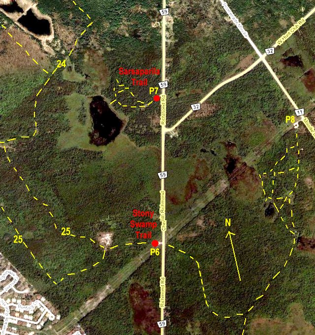
Independent Directions to this Site: From Highway 416 take exit 72 (West Hunt Club Road). If southbound, a 0.4 km offramp dumps onto West Hunt Club Road, where you will turn right or southwest. If northbound, the 0.2 km offramp brings you to Cedarview Road, where you will turn right or SSE onto it and in 0.2 km come to West Hunt Club Road. Turn right or southwest onto it and in 0.4 km join the southbound traffic. Both groups will now follow West Hunt Club southwest for an additional 2.1 km to reach Moodie Drive. Turn right or NNW onto it and drive 0.1 km to reach the continuation of West Hunt Club Road. Turn left or southwest onto this part of West Hunt Club and go 0.8 km to Richmond Road. Cross Richmond Road and enter the parking area for the Sarsaparilla Trail.
Stony Swamp Loop Route Directions: From the Richmond Road Trails parking area, turn left or NNE onto Richmond Road and proceed 1.1 km to the parking area, on the left or west, for the Sarsaparilla Trail.
Site Description and Birding Information: The area has been used for many years as a study area for the Macoun Field Club, the junior field naturalist club sponsored by the Museum of Nature and the Ottawa Field-Naturalists' Club. Their website has an excellent habitat map and pictures of this site. Many young nature lovers had there first exposure to the natural world in this wonderful location.
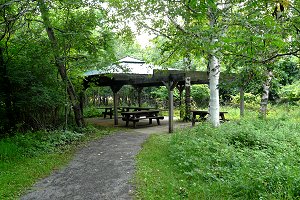
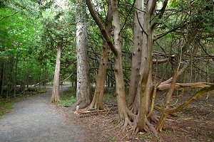
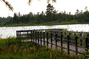
There is a picnic area and wheelchair access at this site. A 0.8 km loop trail goes through a good mix of deciduous and conifer woodland and leads to a pond with a boardwalk viewpoint. The variety of habitat and access to the lake make this an interesting site in which a good variety of birds and other fauna and flora may be seen. This area is adjacent the Richmond Road Trails site, which is also a part of the Macoun study area.
A Northern Goshawk was breeding in this area in 2005.
 |
 |
Stony Swamp Loop Route Directions: This is the last site on this route. From here you could join the Ottawa River West: Ontario route at one of the following nearby sites about 5 km to the north: Ottawa Beach, Andrew Haydon Park, Stillwater - Dick Bell Park, Moodie Drive Marsh & Trails or Grandview Road.