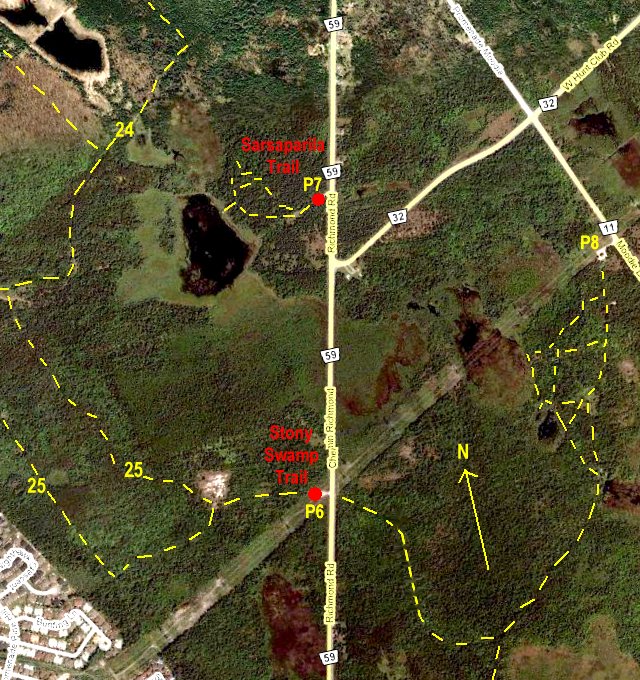
Independent Directions to this Site: From Highway 416 take exit 72 (West Hunt Club Road). If southbound, a 0.4 km offramp dumps onto West Hunt Club Road, where you will turn right or southwest. If northbound, the 0.2 km offramp brings you to Cedarview Road, where you will turn right or SSE onto it and in 0.2 km come to West Hunt Club Road. Turn right or southwest onto it and in 0.4 km join the southbound traffic. Both groups will now follow West Hunt Club southwest for an additional 2.1 km to reach Moodie Drive. Turn right or NNW onto it and drive 0.1 km to reach the continuation of West Hunt Club Road. Turn left or southwest onto this part of West Hunt Club and go 0.8 km to Richmond Road. Turn left or southwest onto Richmond Road and proceed 1.1 km to parking area P6, on the right, for the Richmond Road Trails.
Stony Swamp Loop Route Directions: From the Spectrum Way parking area for the Monaghan Forest, return the 0.1 km northeast on Spectrum to Moodie Drive. Turn right or SSE onto Moodie and proceed 0.4 km to Fallowfield Road, then turn right or southwest onto Fallowfield and proceed 0.7 km to the second parking area for the Monaghan Forest to the right or NNW. Those who've parked there will join our loop now. Follow Fallowfield Road southwest for an additional 1.5 km to Richmond Road and turn right or NNW on it. Drive 3.8 km to parking area P6, on the left or west, for the Richmond Road Trails.
Site Description and Birding Information: The area has been used for many years as a study area for the Macoun Field Club, the junior field naturalist club sponsored by the Museum of Nature and the Ottawa Field-Naturalists' Club. Their website has an excellent habitat map and pictures of this site. Many young nature lovers had there first exposure to the natural world in this wonderful location.
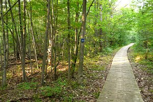
Trail 25 leaves the parking lot heading southwest and after 300 metres splits to create a 3.5 km loop. Taking the northwest lane, at trail 25's most northerly point (c. 1.5 km in), trail 24 heads northeast and eventually comes out in the Westcliffe Estates area of Bells Corners in about 3 km. Trail 24 passes to the west of the adjacent Sarsaparilla Trail site, which is also a part of the Macoun study area. Taking the southwest lane at trail 25's split, you will find the path soon heads northwest, following the northern extension of Scissons Road. To complete trail 25's loop, watch for it leaving Scissons (which goes on as trail 24) and going off to the northeast in about 1.6 km. Trail 24 connects to trail 23 in a further 1.0 km. Trail 23 leads left or WSW to connect to the Old Quarry Trail.
About a kilometer down the trail leading east from P6 on Richmond Road, a Black-backed Woodpecker was found Oct. 13, 2009.
 |
 |
Stony Swamp Loop Route Directions: From the Richmond Road Trails parking area, turn right or NNE onto Richmond Road and proceed 1.1 km to the parking area, on the left or west, for the last site on this loop, the Sarsaparilla Trail.