NORTEL (MOODIE DRIVE) MARSH & TRAILS
Spring: *** Summer: ** Fall: ** Winter: *
Independent Directions to this Site: From Highway 417 (The Queensway) take exit 134 (Moodie Drive). If travelling west, the 0.4 km offramp dumps you right or north onto Moodie. If driving east, a 0.3 km offramp brings you to Moodie Drive, where you will turn left or north onto it and in 0.5 km join the westbound offramp traffic. Both groups will now follow Moodie Drive north 0.9 km from here to the marsh, on the left just before the Nortel Complex South Ring Road on the left. You can either pull well off the road here or turn left or southwest into the ring road and park along it.
Ottawa River West: Ontario Route Directions: From the Stillwater - Dick Bell Park parking lot, turn right or northwest on Carling Avenue and go 1.1 km to Moodie Drive. Turn left or south onto Moodie and proceed 0.4 km to the marsh, on the right just beyond the Nortel Complex South Ring Road on the left. You can either pull well off the road here or turn right or southwest into the ring road and park along it.
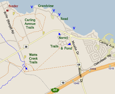 Map of Nortel (Moodie Drive) Marsh & Trails
Site Description and Birding Information: This marsh has been the site of some exciting discoveries recently. It had been notable in the past for having a small heronry farther back, behind the present marshy pond. Construction of the Nortel South Ring Road and various trails may have changed the hydrology and given the birds a new home and us a new birding spot. The heronry, however, seems to be abandoned. The "new" marsh can be best viewed from the trail passing behind it, easily accessible from the Nortel Complex South Ring Road. Trails branch out from the main bicycle path into the area behind the marsh. The bike paths continue south to the Stony Swamp Loop Corkstown Road site and west along the south edge of the Nortel Complex. A new line of thorn bushes blocks the view from the shoulder of Moodie Drive, though one can still walk across to the bushes and peer through them. However, the best views are from the brem paralleling the bike path south of the pond.
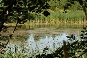 Moodie Drive Marsh Looking West
|
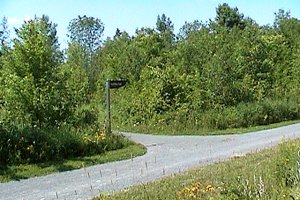 Trail Junction South of Moodie Drive Marsh
|
The pond/marsh seems to be rapidly filling in with cattails. This site may not be as productive in years to come. But, for now, look around the margins of the pond for shorebirds and marshbirds in season. Green Heron can be found in summer. The bike paths traverse second growth woodland and wet spots going west; and marshy and field areas going south toward Corkstown Road. A Great Gray Owl was seen along the latter stretch on both Jan. 9 and 16, 2005.
The Patagonia Picnic Table Effect * was in play here in 2003. A Glossy Ibis was found here May 17, 2003. Two Least Bittern were found later the same day, as well as Sora and Marsh Wren. On Sept. 1, 2003, 4 very vocal and visible Sedge Wren were discovered. Sedge Wrens were discovered singing in the marshy area at Moodie Drive and Corkstown Road in June 2005. (* Bird sightings beget more bird sightings. Derives from rare bird discoveries at a Patagonia, AZ picnic area.) A male Red-bellied Woodpecker was seen on the trail west of parking lot in the Nortel Campus on Mar. 11-13, 2007.
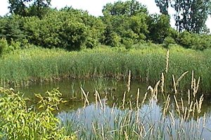 Moodie Drive Marsh Looking East
|
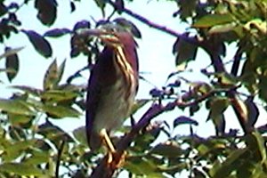 Green Heron - Moodie Drive Marsh - July 10, 2004
|
Ottawa River West: Ontario Route Directions: From where you are parked to visit the Moodie Drive Marsh & Trails, return to Moodie Drive and take it NNW for 0.4 km to Carling Avenue. Turn left or WNW onto Carling and drive 0.3 km to Grandview Road. Turn right or northeast onto our next site, Grandview Road.
Return to Ottawa River West: Ontario.
Return to Birding Ottawa Table of Contents.
|