RIDEAU RIVER PROVINCIAL PARK
Spring: ** Summer: * Fall: * Winter: *
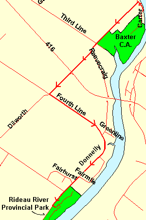
Independent Directions to this Site: From Highway 416 (The Veteran's Memorial Highway) take exit 42 (Dilworth Road) and turn southwest on it. Follow Dilworth Road or Regional Road 16 southwest 1.0 km to North Gower Road or Regional Road 5 or Fourth Line. Turn left or southeast onto it and follow it 2.0 km to a sharp righthand turn where it becomes Donnelly Road or Regional Road 2. Drive another 2.0 km southwest on Donnelly to the entrance, on the left, of the Rideau River Provincial Park. Turn left or southeast into the park road.
Rideau River West Side Route Directions: From the Baxter Conservation Area, return to the junction of Dilworth Road or Regional Road 16 and Rideau Valley Drive South. Turn left or southwest onto Dilworth Road or Regional Road 16 and proceed 3.7 km southwest to North Gower Road or Regional Road 5 or Fourth Line. Turn left or southeast onto it and follow it 2.0 km to a sharp righthand turn where it becomes Donnelly Road or Regional Road 2. Drive another 2.0 km southwest on Donnelly to the entrance, on the left, of the Rideau River Provincial Park. Turn left or southeast into the park road.
 Map of Rideau River Provincial Park
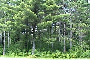
Site Description and Birding Information: This popular provincial park is mostly a mid-May to mid-September campground, with attendent fees. In the off-season a gate blocks the roadway into the park, so access is on foot. The park has a 2.3 km shoreline on the Rideau River and a short "fitness" trail. This is reforested farmland with pines, silver maples and other deciduous woods. Heavy use during the summer season makes it less attractive birdwise, but a camping birder might find it a good base.
 View of Rideau River Provincial Park
Rideau River West Side Route Directions: This is the last site along the Rideau River West Side Loop. You could return to Ottawa via the Rideau River East Side Loop at Burritts Rapids or join the adjacent Marlborough Forest Loop. The closest site in the latter loop is Harnett Road. To return to Ottawa directly, return 4.0 km northeast, then northwest, along Regional 5; then turn right or northeast onto Dilworth Road. Go 1.0 km to Highway 416 (exit 42). Proceed north 36 km to the junction of Highway 417 in Ottawa.
Return to Rideau River West Side.
Return to Birding Ottawa Table of Contents.
|