NEW EDINBURGH PARK
Spring: * Summer: * Fall: * Winter: *
Independent Directions to this Site: From Highway 417 (The Queensway) take exit 118 (Nicholas Street). Avoid doing this during rushhour! Go northwest 1.8 km to Rideau Street and turn right or northeast onto it. In 0.3 km King Edward Avenue will be on the left or northwest side. From the corner of Rideau Street and King Edward Avenue, turn left or northwest onto King Edward and proceed 1.2 km to the Minto Bridges. Turn right or NNE onto the bridges and cross them to Stanley Avenue in 0.4 km. Park on Stanley as close as possible to the bridge. The park is south of Stanley Avenue and east of the bridge.
Rideau River East Side Route Directions: From Maple Island, simply leave your car where it is; and instead of returning all the way to Stanley Avenue, turn right after crossing the bridge and enter New Edinburgh Park. The park is south of Stanley Avenue and east of the bridge.
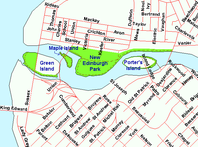 Map of the New Edinburgh Park area
Site Description and Birding Information: This 0.3 by 0.4 km park is largely open field area jutting out into the Rideau River near its mouth. There are several trails, including one along the river. There are two small marshy sections along the margin. The bushes along the shore of Maple Island are viewable from the western end of the park. There are some old willows along the shore at the eastern end of the park and close views of Porter's Island across the channel. A planting of saplings toward the eastern end of the park may bear birds in time.
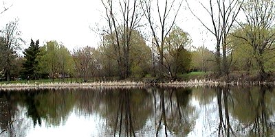 View of New Edinburgh Park from Maple Island
Rideau River East Side Route Directions: From Stanley Avenue and the Minto Bridges, go ESE on Stanley 0.6 km, where it turn left to become Dufferin Road. Follow Dufferin 0.1 km NNE to Crichton Street and turn right or ESE onto it. Go 0.4 km ESE on Crichton to Beechwood Avenue and continue straight across the intersection onto what is now called the Vanier Parkway. Drive 1.0 km southeast on Vanier to Montreal Road. Turn right or NNW on Montreal and go 0.4 km to River Road, just before reaching the Cummings Bridge. Turn right or NNW on River Road and proceed 0.5 km to its dead end, where you can park to visit our next site on this route, Kingsview Park.
Return to Rideau River East Side.
Return to Birding Ottawa Table of Contents.
|