PORTER ISLAND
Spring: * Summer: * Fall: * Winter: *
Independent Directions to this Site: From Highway 417 (The Queensway) take exit 118 (Nicholas Street). Avoid doing this during rushhour! Go northwest 1.8 km to Rideau Street and turn right or northeast onto it. In 0.3 km King Edward Avenue will be on the left or northwest side. From the corner of Rideau Street and King Edward Avenue, turn left or northwest onto King Edward and proceed 0.4 km to St. Patrick Street. Turn right or northeast onto St. Patrick and go 0.8 km to Island Lodge Road. Turn left or north onto it and enter Porter Island.
Rideau River West Side Route Directions: From the Green Island parking lot, go back to Sussex Drive and turn left or SSW onto it. After 0.2 km turn left or southeast onto King Edward Avenue. Go 0.9 km southeast on King Edward to St. Patrick Street. Turn left or northeast on it and proceed 0.7 km to Island Lodge Road. Turn left or north onto it and enter Porter Island.
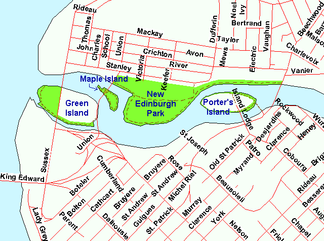 Map of Porter Island area
Site Description and Birding Information: Island Park Lodge, a retirement home, occupies the eastern half of this small island in the middle of the Rideau River. A construction site now occupies the western end, perhaps a companion lodge. Please show respect for this private property. The perimeter of the island is lined with beautiful, overhanging trees and some bushes, which can be alive with migrants, especially in spring. It is worth walking this edge, especially at the eastern end. Birding from the footbridge that crosses to St. Patrick Street near the east end of the island allowing good views of the drooping limbs from the outside. This footbridge is closed to traffic in the winter, which seems to include at least the first week of May! But, for the agile among us, it presents easy access. The river channel should be checked in the cooler months for waterfowl. New Edinburgh Park lies across the channel from the western end of the island.
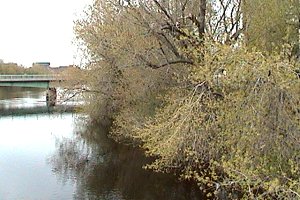 View of Porter Island
Rideau River West Side Route Directions: From Porter Island, return to St. Patrick Street and cross it, following Cobourg Street southeast 0.6 km to Rideau Street. Turn left or northeast onto it and immediately (0.1 km) turn right or southeast onto Charlotte Street. After 0.5 km turn right or southwest onto Laurier Avenue East, then immediately (0.1 km) turn left or southeast onto Range Road. Travel 0.4 km southeast on Range and turn left or northeast at Somerset Street East into the parking area for our next site on this route, Strathcona Park.
Return to Rideau River West Side.
Return to Birding Ottawa Table of Contents.
|