Independent Directions to this Site: From Boulevard des Allumettières or Highway 148, take the Chemin Vanier exit. Turn left or south onto Vanier and go 0.3 km to Chemin McConnell. Turn left or east on McConnell and proceed 1.1 km to Chemin Rivermead. Turn right and follow Rivermead south for 2.3 km to Boulevard de Lucerne. Turn right and go 0.1 km to a pulloff on the left. Turn left into the small parking area, where a blocked off dirt road goes down to the river, to bird the Rivermead area.
Ottawa River West: Quebec Route Directions: From the Chaudière parking area, turn left or southwest onto Boulevard de Lucerne and drive 1.3 km to a small parking area on the left. Turn left or southeast into this lot and park here, where a blocked off dirt road goes down to the river, to bird the Rivermead/Baie Simard area.
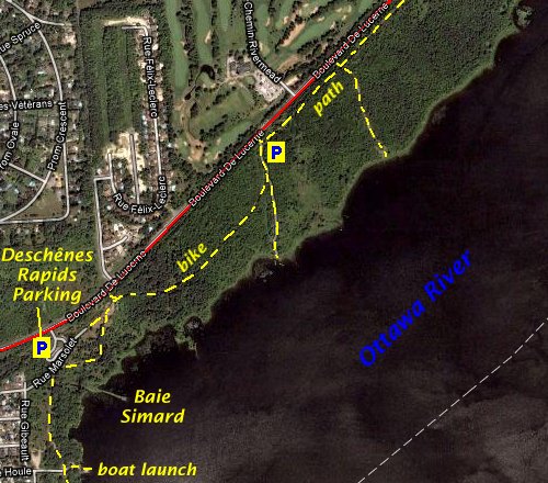
Site Description and Birding Information: This site, opposite the Rivermead Golf Club, provides access to a section of Ottawa River shoreline not visible from nearby Deschênes Rapids site just to the SW. Walk the dirt road to the shore. The major attraction here is the large gatherings of waterfowl in spring and fall. The entire strip of land SE of Boulevard de Lucerne, mostly NCC land, through which a bike path weaves, is good for migrant land birds. The main bay east of the Deschênes Rapids is known to francophone birders as Baie Simard. Baie Simard can also be reached from the Deschênes Rapids parking area a further 0.9 km southeast on Boulevard de Lucerne.
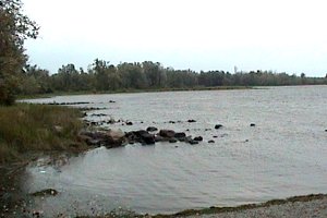
In spring and autumn, waterfowl cluster in and around the small coves along here. Large rafts of Ring-necked Duck and scaup gather here, giving plenty of oppurtunity to compare the three species. As well as all the common Ottawa birds, many less common waterfowl, such as Gadwall, Redhead, Canvasback, Black and Surf Scoter, and Red-breasted Merganser are often found here. A Eurasian Wigeon spent several falls between here and Britannia.
The scrubby area between the road and shore is good for migrants, and wintering sparrows. A bike path traverses the entire area and is a good route for exploring, as long as you stay off to one side. Remember, it is a bike path and bicycles don't make much noise.
During the peak of gull and tern activity at Deschênes Rapids, it is a good idea to watch for patrolling birds working along the river. Less common birds, such as Bonaparte's Gulls and Common and Black Terns are normally present in small numbers, and rarities show up regularly among the swirling Ring-billed and Herring Gulls and multitudes of swallows.
Purple Sandpiper, most likely around the first week of November, has been seen on the rocks near the shore.
This is a good area for winter birds of prey, such as Snowy Owl, Merlin and Peregrine Falcon coming in for their meals. Bald Eagle has been seen in spring and fall.
Rarities found at this site recently include: Eurasian Wigeon (falls of 1989 through 1992); Sabine's Gull (juv. Sept. 12-13, 2007).
Ottawa River West: Quebec Route Directions: From the Rivermead parking area, turn left or southwest onto Boulevard de Lucerne and drive 1.3 km (or 0.4 km if you are at the Deschênes Rapids parking area) to Chemin Vanier. Turn right or north into it and proceed 0.5 km to Promenade Crescent. Turn right or east into our next site on this route, Lakeview Terrace.