PINHEY POINT
Spring: * Summer: ** Fall: * Winter: *
Independent Directions to this Site: From Highway 417 (The Queensway) take exit 138 (Eagleson/March Roads). If travelling west, the 0.6 km offramp sends you right or north onto March Road. If driving east, a 0.4 km offramp brings you to Eagleson Road, where you will turn left or north onto it and in 0.5 km join the westbound offramp traffic on March Road (it changed names as you went under the overpass). Both groups will now follow March Road northwest 8.0 km to Dunrobin Road. Turn right or north onto Dunrobin and go 0.2 km to Riddell Road. Turn right on Riddell and go northeast 4.4 km to its end. Follow the main road as it make a right angle turn to the northwest and becomes Sixth Line Road. Follow Sixth Line 5.0 km to Pinhey Point Road.
Ottawa River West: Ontario Route Directions: From the river end of Berry Side Road, return the one kilometer southwest to Sixth Line Road. Turn right or northwest onto Sixth Line Road and proceed 1.9 km to Pinhey Point Road. Turn right or northeast onto it.
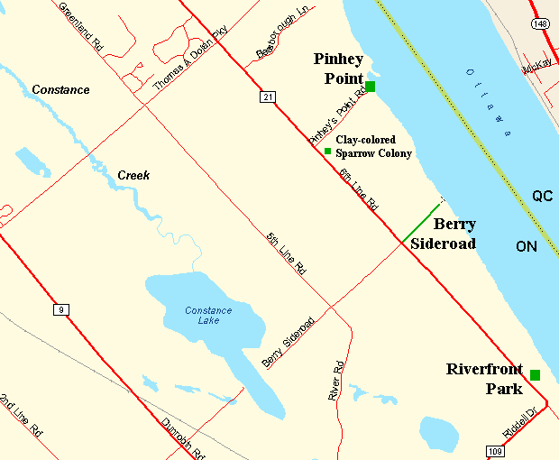 Map of the Pinhey Point area
Site Description and Birding Information: The fascinating historical site here provides public access to this section of the Ottawa River. Watch for Eastern Bluebirds here.
On Sixth Line Road, just southeast of the Pinhey Point Road, watch (or rather listen) for breeding Clay-coloured Sparrows.
A Northern Mockingbird was seen here on Apr. 23, 2006. On Sixth Line Road, northwest of the Pinhey Point Road (half way to the Thomas Dolan Parkway), a Great Gray Owl was seen on Feb. 8, 2006.
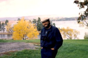 Author at Pinhey Point (1992)
Ottawa River West: Ontario Route Directions: From the river end of Pinhey Point Road, return the one kilometer southwest to Sixth Line Road. Turn right or northwest onto Sixth Line Road and proceed 2.0 km to the Torbolton Townline, a.k.a. Thomas Dolan Parkway. Turn right or northeast onto the Thomas Dolan Parkway and go 1.8 km to Barlow Road and the next site, Dunrobin Shore - Baskin's Beach.
Return to Ottawa River West: Ontario.
Return to Birding Ottawa Table of Contents.
|