Independent Directions to this Site: Going north on Autoroute de la Gatineau or Highway 5 take Exit # 2, the Autoroute 50 east exit. Follow the long, 1.0 km, ramp over Brewery Creek and onto Autoroute 50 headed north. Proceed 11.2 km to exit 147, taking the Boulevard Labrosse exit. Follow the 0.4 km exit ramp to Labrosse and turn right or south onto it. Go 2.9 km south to Boulevard Maloney Est and turn left or east on it. Proceed 1.5 km east on Maloney and turn left or north into Parc du Lac Beauchamp. Go 0.6 to 1.0 km to one of the parking areas at the lake.
Ottawa River East: Quebec Route Directions: From where you are parked on Rue Jacques Cartier to visit Kettle Island, go to Jacques Cartier's northeast end at its junction with Rue St-Louis. Turn right or ENE on St-Louis and go 0.6 km to a lefthand turn where the road becomes Avenue du Golf. The golf course is on your left. Follow du Golf 1.2 km to Boulevard Maloney Ouest and turn right or east on it. Drive 3.3 km east on Maloney to the lefthand turnoff for Parc du Lac Beauchamp. Turn left or north into Parc du Lac Beauchamp and go 0.6 to 1.0 km to one of the parking areas at the lake.
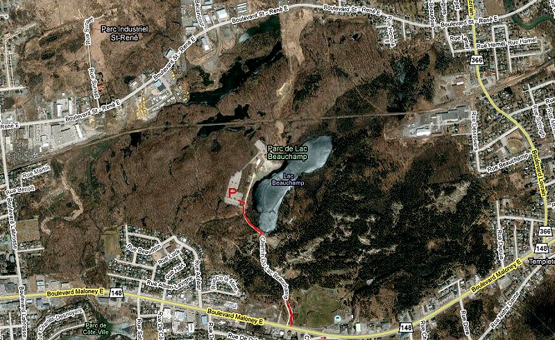
Site Description and Birding Information: This 300 hectare park is heavily used in summer by swimmers and in winter by skaters and skiers. Mixed woodland surrounds the 8 hectare lake. A series of trails loop through the forest. Trail maps are sometimes available at the entrance.
In winter such birds as Pileated Woodpecker, Ruffed Grouse and Brown Creeper are amoung the possibilities. Le club des ornithologues de l'Outaouais (COO) operates feeders at the south end of the lake. They are along the trail on the east side of the lake.
In summer breeding birds include Nashville Warbler, Pine Warbler, Brown Thrasher, Rose-breasted Grosbeak and Ruby-throated Hummingbird.
Ottawa River East: Quebec Route Directions: From the parking area at Parc du Lac Beauchamp, return south to Boulevard Maloney Est and turn left or east on it. Follow Maloney east for 2.5 km to Rue des Sables. Turn right or south on des Sables and go 0.2 km to Rue Notre-Dame. Turn left or east on Notre-Dame and proceed about 0.4 km to an old road, now only a trail, leading off to the right or south opposite 1105 Notre-Dame. If you reach Rue Bigras, you have gone a bit too far. This is the access for our next site on this route, Baie McLaurin. There is a pulloff here where you can park.