KETTLE ISLAND
Spring: ** Summer: * Fall: ** Winter: *
Independent Directions to this Site: Going north on Autoroute de la Gatineau or Highway 5 take the Fournier Boulevard east exit. Follow the ramp 0.2 km to Fournier, then follow Fournier 2.4 km northeast to Jacques Cartier at the far side of the Lady Aberdeen Bridge over the Gatineau River. Turn right or southeast on Jacques Cartier and follow it for 1.0 km to Prince Albert. Parking is possible at several places from here to the end of Jacques Cartier 2.2 km beyond Prince Albert.
Ottawa River East: Quebec Route Directions: From Parc de la Baie, you can reach Kettle Island by boat or canoe directly off Jacques Cartier. Alternately, you could launch from farther downstream - from the Parc Sanscartier area.
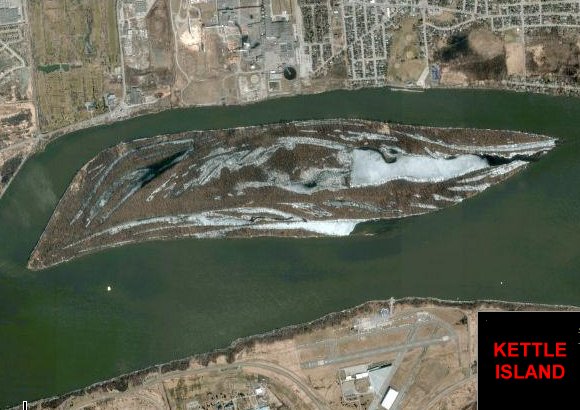 Satellite Image Map of Kettle Island area
Site Description and Birding Information: This marshy island in the Ottawa River is accessable only by boat. It is especially interesting during migration.
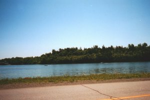 View of Kettle Island
|
|
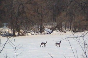 Deer Crossing Ice from Kettle Island
|
Ottawa River East: Quebec Route Directions: From where you are parked on Rue Jacques Cartier, go to its northeast end at its junction with Rue St-Louis. Turn right or ENE on St-Louis and go 0.6 km to a lefthand turn where the road becomes Avenue du Golf. The golf course is on your left. Follow du Golf 1.2 km to Boulevard Maloney Ouest and turn right or east on it. Drive 3.3 km east on Maloney to the lefthand turnoff for our next site on this route, Parc du Lac Beauchamp. Turn left or north into Parc du Lac Beauchamp and go 0.6 to 1.0 km to one of the parking areas at the lake.
Return to Ottawa River East: Quebec.
Return to Birding Ottawa Table of Contents.
|