PLAISANCE SECTOR - PARC NATIONAL DE PLAISANCE
Spring: *** Summer: ** Fall: *** Winter: *
Independent Directions to this Site: Going north on Autoroute de la Gatineau or Highway 5 take Exit # 2, the Autoroute 50 east exit. Follow the long, 1.0 km, ramp over Brewery Creek and onto Autoroute 50 headed north. Proceed 30 km to exit 166 (the final exit on 50 at this time), following the exit ramp 0.6 km as it loops back around to Rue Notre-Dame. Turn left or south and go 0.6 km SSE to where Chemin de Montréal or Highway 148 join Notre-Dame. Continue straight SSE 0.2 km to where Chemin de la Quai splits off to the right. Continue on Chemin de Montréal or Highway 148 by bearing left or ENE and going 26.6 km on it to about 1 km past the town of Plaisance. Turn right or south into the entrance to the Plaisance Sector of parc national de Plaisance or the Plaisance Provincial Park.
Ottawa River East: Quebec Route Directions: From the Baie Noire parking area, return to Chemin de Montréal Ouest or Highway 148 and continue east 5.5 km on it to about 1 km past the town of Plaisance. Turn right or south into the entrance to the Plaisance Sector of parc national de Plaisance.
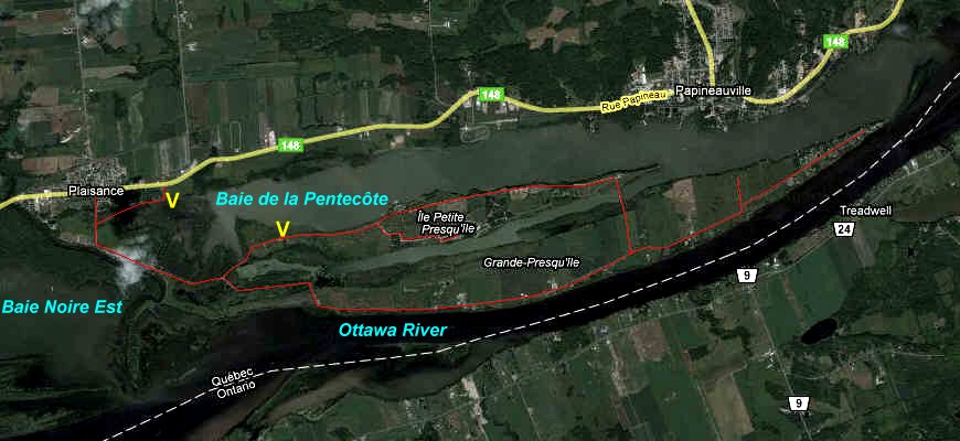 Google Satellite Map of the Plaisance Sector Area
Site Description and Birding Information: This site is just outside the OFNC checklist circle. It is part of the newly created Plaisance Provincial Park or parc national de Plaisance. The area is presently being developed as a new park that extends 22.5 km from Thurso, through the Presqu'îles, to as far east as Île à Roussin. This sector consists of a 0.8 kilometre stretch of road along the inner western most reaches of the Baie de la Pentecôte and through a portion of maturing deciduous woodland. Good views of this portion of the bay can be had from the picnic area where the road first reaches the bay. Unfortunately, this allows a view of only a small portion of this famous waterfowl mecca. It may be worth checking. Use a scope.
From Apr. 17 - 28, 2004 a rare Pink-footed Goose hung out in the Baie de la Pentecôte. Two Trumpeter Swans were seen in the bay from here on April 12, 2006. A Greater White-fronted Goose visited the bay on Apr. 9, 2011.
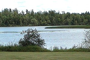 View of Baie de la Pentecôte
Ottawa River East: Quebec Route Directions: When you have reached the end of the road through the Plaisance Sector of the Plaisance Provincial Park and encountered Chemin des Presqu'îles, turn left or south onto it and go 0.4 km the the gatehouse for the next site on this route, Grande & Petite Presqu'île in the Plaisance Provincial Park.
Return to Ottawa River East: Quebec.
Return to Birding Ottawa Table of Contents.
|