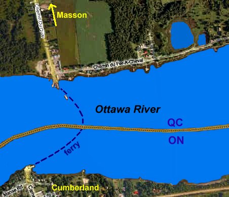
MASSON FERRY DOCK
Spring: ** Summer: ** Fall: ** Winter: *
Independent Directions to this Site: Going north on Autoroute de la Gatineau or Highway 5 take Exit # 2, the Autoroute 50 east exit. Follow the long, 1.0 km, ramp over Brewery Creek and onto Autoroute 50 headed north. Proceed 30 km to exit 166 (the final exit on 50 at this time), following the exit ramp 0.6 km as it loops back around to Rue Notre-Dame. Turn left or south and go 0.6 km SSE to where Chemin de Montréal or Highway 148 join Notre-Dame. Continue straight SSE 0.2 km to where Chemin de la Quai splits off to the right. Bear right or southeast on Chemin de la Quai and go 1.8 km to the Masson-Angers municipal dock, from which the Masson-Cumberland ferry leaves every few minutes to cross the Ottawa River ($6.00). Park near here for access to the marshes near the Masson Ferry Dock.
Ottawa River East: Quebec Route Directions: From the Masson Sewage Lagoons, return northeast on Chemin de la Pointe 1.5 km to Chemin de la Quai. Turn right or southeast onto it and proceed 1.2 km to the Masson-Angers municipal dock, from which the Masson-Cumberland ferry leaves every few minutes to cross the Ottawa River ($6.00). Park near here for access to the marshes near the Masson Ferry Dock.
 MS Virtual Satellite Map of Masson Ferry Dock
Site Description and Birding Information: This site is part of the recent initiative of Quebec Parks and Wildlife, Ducks Unlimited and the North American Waterfowl Management Plan. They indicate a public access to the Marais des Sarcelles to the west on their maps, but it is not yet in evidence on the ground. Park near the dock and head west.
East 0.8 km along the shore road, Chemin du Fer-à-Cheval, is Domaine du Fer-à-Cheval, a joint environmental initiative of the Ville de Masson-Angers and the Association Les Riverains de Masson-Angers.
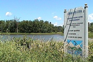 View of Domaine du Fer-à-Cheval
Ottawa River East: Quebec Route Directions: From the Masson Ferry Dock, return NNW on Chemin de la Quai for 1.8 km to the junction with Highway 148. Turn right or ENE onto 148 and proceed 2.1 km to Chemin Wilfred-Lèpine (formerly Chemin Line). Turn right or south on it just before reaching the mill yard and drive 0.4 km to a T-junction. Turn left or east and go 0.2 km to the next site on this route, the pond behind the mill off Chemin Wilfred-Lépine.
Return to Ottawa River East: Quebec.
Return to Birding Ottawa Table of Contents.
|