CHEMIN WILFRED LÉPINE
Spring: ** Summer: ** Fall: ** Winter: *
Independent Directions to this Site: Going north on Autoroute de la Gatineau or Highway 5 take Exit # 2, the Autoroute 50 east exit. Follow the long, 1.0 km, ramp over Brewery Creek and onto Autoroute 50 headed north. Proceed 30 km to exit 166 (the final exit on 50 at this time), following the exit ramp 0.6 km as it loops back around to Rue Notre-Dame. Turn left or south and go 0.6 km SSE to where Chemin de Montréal or Highway 148 join Notre-Dame. Continue straight SSE 0.2 km to where Chemin de la Quai splits off to the right. Continue on Chemin de Montréal or Highway 148 by bearing left or ENE and go 2.1 km to Chemin Wilfred-Lèpine (formerly Chemin Line). Turn right or south on it just before reaching the mill yard and drive 0.4 km to a T-junction. Turn left or east and go 0.2 km to the pond behind the mill off Chemin Wilfred-Lépine.
Ottawa River East: Quebec Route Directions: From the Masson Ferry Dock, return NNW on Chemin de la Quai for 1.8 km to the junction with Highway 148. Turn right or ENE onto 148 and proceed 2.1 km to Chemin Wilfred-Lèpine (formerly Chemin Line). Turn right or south on it just before reaching the mill yard and drive 0.4 km to a T-junction. Turn left or east and go 0.2 km to the pond behind the mill off Chemin Wilfred-Lépine.
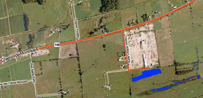 MS Virtual Satellite Map of the Chemin Wilfred-Lépine Area
Site Description and Birding Information: Off the end of Chemin Wilfred-Lépine, behind the millworks, is a lovely marshy pond which can have waterfowl, marsh birds or shorebirds in season. One of the better spots for shorebirds on the Quebec side of the river. An American Golden Plover was seen here Sep. 22, 2001.
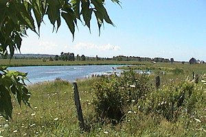 View of Pond off Chemin Wilfred-Lépine
Ottawa River East: Quebec Route Directions: From the pond behind the millworks, return 0.2 km west to Chemin Wilfred-Lépine. Turn right or north on it and return 0.4 km to Chemin de Montréal Ouest or Highway 148. Turn right or ENE onto it and proceed 1.3 km to the next site on this route, La Ferme Soleil.
Return to Ottawa River East: Quebec.
Return to Birding Ottawa Table of Contents.
|