EAST END OF LOUGHLIN RIDGE ROAD
Spring: ** Summer: ** Fall: ** Winter: **
Independent Directions to this Site: From Highway 416 take exit 34 (Kemptville) to Leeds & Grenville 43. Turn left or east onto Leeds & Grenville 43 after the 0.3 km exit ramp. Follow 43 northeast 8.6 km to Hallville and County Road 1. Turn left or northwest onto it and proceed 1.6 km to Loughlin Ridge Road. Turn right or northeast onto it and proceed 1.8 km to the end of the gravelled portion of this road, to the East End of Loughlin Ridge Road site.
South Gower / Mountain Loop Directions: From the East End of French Settlement Road, return 1.8 km to Reids Mills Road (County # 1). Turn left or southeast on it and go 2.8 km to Loughlin Ridge Road. Turn left or northeast onto it and proceed 1.8 km to the end of the gravelled portion of this road, to the East End of Loughlin Ridge Road site.
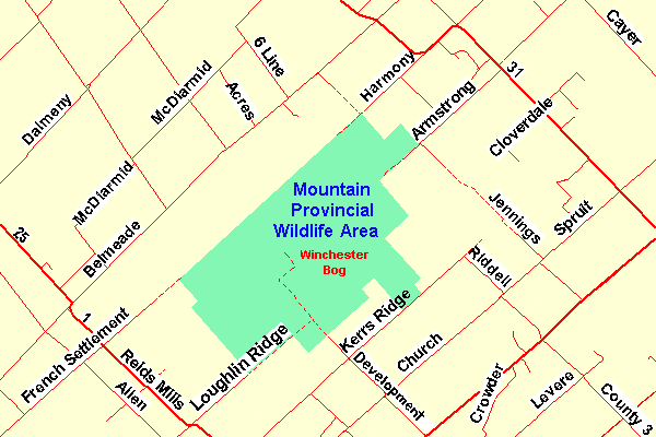 Map of the Winchester Bog Area
Site Description and Birding Information: This old roadbed or dirt track along the southwestern corner of the Winchester Bog passes through woodland and mixed habitat to the north and farmland to the south for nearly 2 km before reaching the northwesterly extension of Development Road and the Mountain Provincial Wildlife Area site. Land ownership seems unclear. The land to the north appears from the maps to be a part of the Mountain Provincial Wildlife Area, but some of it seems to be in private use. The road itself should provide good birding, in any case, especially during migration. About a kilometre in, a Great Gray Owl was found in the great invasion winter (Jan. 18, 2005).
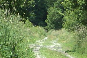 Along the East End of Loughlin Ridge Road
On the way from the last site to here, note the pond along Allen Creek on the left or east side of Reids Mills Road, which can have waterfowl in season. It had a Ross' Goose Nov. 21 - 26, 2004, with a flock of 140 Snow Geese. Also check the sod farms along Loughlin Ridge Road on the way into the site.
South Gower / Mountain Loop Directions: From the end of the gravelled portion of the East End of Loughlin Ridge Road, return the 1.8 km to Reid Mills Road (County # 1). Turn left or southeast on it and go 1.5 km to Kerrs Ridge Road at Hallville. Turn left or northeast onto it and proceed 3.6 km to Development Road. Turn left or northwest into it at the sign for the next site on this route, the Mountain Provincial Wildlife Area. Drive 0.7 km to the edge of the Wildlife Area, where you can park by the Ruffed Grouse Society of Canada's Wildlife Habitat Project sign.
Return to South Gower / Mountain Loop.
Return to Birding Ottawa Table of Contents.
|