EAST END OF FRENCH SETTLEMENT ROAD
Spring: ** Summer: ** Fall: * Winter: *
Independent Directions to this Site: From Highway 416 take exit 40 (River Road). Loop around to River Road or Regional 19 and go right or northeast on it for 3.3 km to South Gower Boundary Road. Turn right or south on it and go 3.4 km to French Settlement Road. Turn left or northeast onto it and drive 5.8 km to the end of the gravelled portion of this road (just beyond house number 10761), to the East End of French Settlement Road site.
South Gower / Mountain Loop Directions: From wherever you are on South Gower Boundary Road, return to French Settlement Road, which is 3.4 km southeast of River Road, and turn northeast onto it. Go 5.8 km to the end of the gravelled portion of this road (just beyond house number 10761), to the East End of French Settlement Road site.
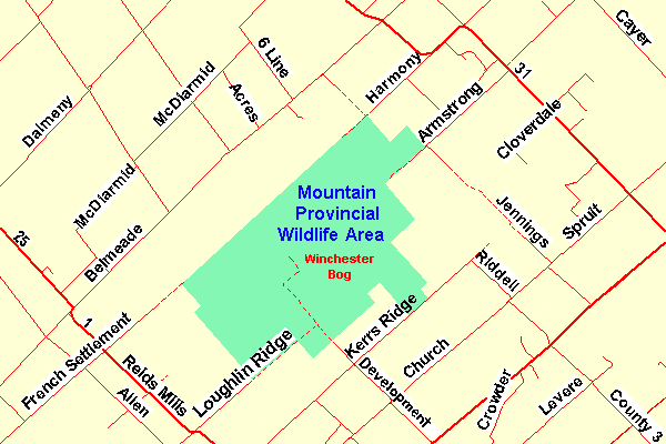 Map of the Winchester Bog Area
Site Description and Birding Information: This old roadbed into the northwestern corner of the Winchester Bog passes through farmland for about a kilometre before reaching the edge of the woodland. The roadbed right-of-way is overgrown and provides plenty of edge habitat, with enough trees to satisfy even Least Flycatchers. Allen Creek provides water interest.
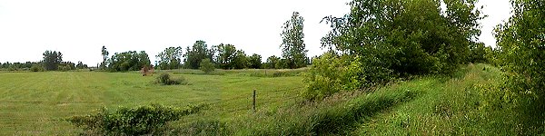 East End of French Settlement Road
South Gower / Mountain Loop Directions: From the East End of French Settlement Road, return 1.8 km to Reids Mills Road (County # 1). Turn left or southeast on it and go 2.8 km to Loughlin Ridge Road. Turn left or northeast onto it and proceed 1.8 km to the end of the gravelled portion of this road, to the next site on this route, the East End of Loughlin Ridge Road.
Return to South Gower / Mountain Loop.
Return to Birding Ottawa Table of Contents.
|