BENNETT ROAD QUARRY
Spring: ** Summer: ** Fall: ** Winter: *
Independent Directions to this Site: From the junction of Highways 417 (The Queensway) and 416, go south SSE on 416 for 41 km to exit 34, or County Road 43, the Kemptville turnoff. Exit right off 416 and turn left, or ESE, onto CR43. Proceed east 3.0 km to county Road 22, then turn right or SSE onto it. Drive 3.7 km to Bennett Road. Turn left or ENE onto Bennett and go 1.1 km to view the Bennett Road Quarry, on your left.
South Gower / Mountain Loop Directions: From the west end of the Guy-Cameron Roads area, at the junction of Cameron and Boundary Roads, continue straight southwest for 2.5 km on the same road, which now becomes the Edward Scott Road. Here, at County Road 22, turn right or NNW and drive 4.0 km to Bennett Road. Turn right or ENE onto Bennett and go 1.1 km to view, on your left, the next site on this route, the Bennett Road Quarry.
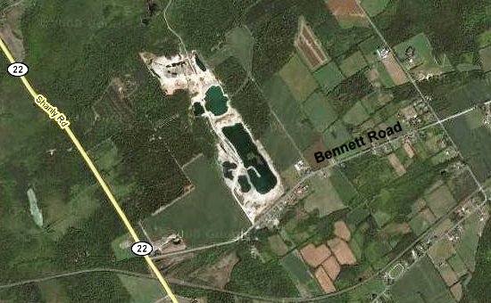 Google Satellite Map of the Bennett Road Quarry area
Site Description and Birding Information: This quarry extends well over a kilometer to the NNW of Bennett Road and is partly visible from the roadway. Please keep in mind that this is private property. Given the propensity of quarries to attract various groups of water birds, it may be worth checking if you are in the area.
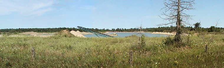 Panoramic View of the Quarry from Bennett Road
South Gower / Mountain Loop Directions: From the Bennett Road Quarry return WSW to Couny Road 22 and turn left or SSE onto it. Drive 0.3 km to Whitney Road, on the right. Turn right or WSW onto Whitney and proceed 0.9 km to the last site on this route, the Whitney Road Marsh.
Return to South Gower / Mountain Loop.
Return to Birding Ottawa Table of Contents.
|