GUY-CAMERON ROADS
Spring: ** Summer: *** Fall: ** Winter: **
Independent Directions to this Site: From Highway 417 (The Queensway) take exit 96 (Boundary Road). Proceed 20.0 km SSE on Boundary Road (Regional 41) to Marionville Road at Marionville. Turn right or WSW onto Marionville Road and drive 1.2 km to Bisson Road. Turn left or SSE onto it and go 1.5 km to Ormond Road. Turn right or WSW onto it and proceed 5.7 km to Regional 31 at Harmony. Turn left or SSE onto Regional 31 and drive 12.3 km to Baker Road. Turn right or WSW onto Baker and go 1.8 km, where it becomes Guy Road. Guy Road turns into Cameron Road a further 4.2 km WSW at Inkerman.
South Gower / Mountain Loop Directions: From the Winchester Sewage Lagoons entrance at Liscumb Road (County 3 here) return WSW the less than one kilometre to Ottawa Street. Continue on County 3 here by taking the lefthand turn to the SSE and drive 1.4 km to the junction of Boyne Road or Main Street East. Turn right or southwest continuing on County 3 or Main Street East through Winchester for 0.3 km to County 38 or St. Lawrence Street. Turn left or SSE onto 38, go 2.3 km to Highway 31. Turn left or SE onto 31 and proceed 1.8 km to Baker Road. Turn right or WSW onto Baker and go 1.8 km, where it becomes Guy Road. Guy Road turns into Cameron Road a further 4.2 km WSW at Inkerman (but requires a left turn).
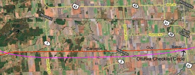 Map of the Guy-Cameron Roads area
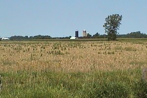
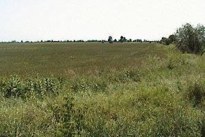
Site Description and Birding Information: This road is the most southeasterly one inside the Ottawa Checklist Circle. It runs through agricultural land cut by the occasional creek or ditch. All land visible north of the road is inside the circle, but south of the road the boundary is never more than half a kilometer away. The circle passes just a few meters south of the junction of Highway 31 and Baker Road. By the time you reach Guy Road it is around 200 meters to the south. It increases to around a half a kilometer by the time it reaches Inkerman Road, where Guy turns into Cameron Road. It maintains roughly 500 meters for about 6.5 km until reaching Lough Road, after which it decreases again. The circle crosses Cameron Road at Boundary Road, 4.5 km beyond Lough Road.
This road runs parallel to the St. Lawrence River on the circle's closest side to it, a mere 22 km away to the SE. That alone makes it worth exploring. Who knows what may turn up? In mid-May 2010, a Lazuli Bunting visited a home along Cameron Road.
Farmland along the Guy-Cameron Roads
South Gower / Mountain Loop Directions: From the west end of the Guy-Cameron Roads area, at the junction of Cameron and Boundary Roads, continue straight southwest for 2.5 km on the same road, which now becomes the Edward Scott Road. Here, at County Road 22, turn right or NNW and drive 4.0 km to Bennett Road. Turn right or ENE onto Bennett and go 1.1 km to view, on your left, the next site on this route, the Bennett Road Quarry.
Return to South Gower / Mountain Loop.
Return to Birding Ottawa Table of Contents.
|