McCAFFERY TRAIL
Spring: ** Summer: * Fall: ** Winter: *
Independent Directions to this Site: From Highway 417 (The Queensway) take exit 145 (Highway 7). The offramp continues directly as Highway 7. Continue south, the southwest on Highway 7 for 13.8 km to the Ashton Station Road. Turn left or southeast onto it and go 2.3 km to McCaffery Trail. Turn left or east onto it and drive 2.3 km to the Jock River biridge.
Mississippi River Valley Route Directions: From the Ashton Station Trailway on Ashton Station Road, continue southeast 0.2 km on Ashton Station to Highway 7. Continue southeast across Highway 7 and follow it another 2.3 km southeast to McCaffery Trail. Turn left or east onto it and drive 2.3 km to the Jock River biridge.
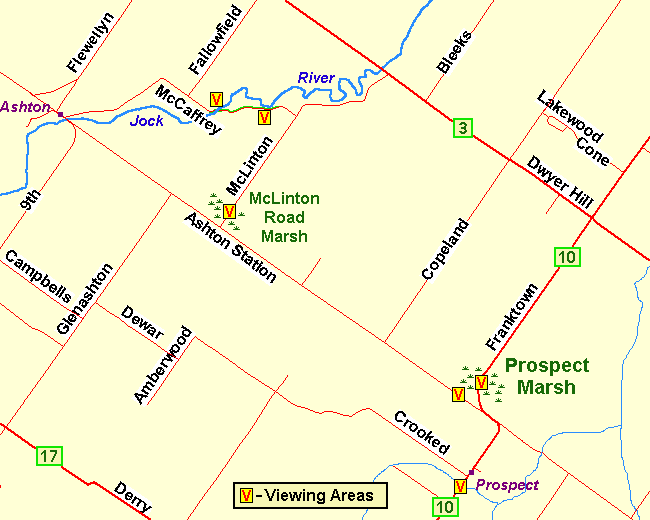 Map of the McCaffery Trail area
Site Description and Birding Information: This stretch of McCaffery Trail parallels the Jock River, and as the river winds back and forth, it sometimes comes very close to the road. Beginning at the bridge the Jock is alongside the road for close to 200 metres, and again 400 metres farther along, it is close for another 200 metres. The riparian vegetation on the the stream side of the road is complemented by the fields on the opposite side.
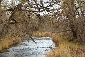
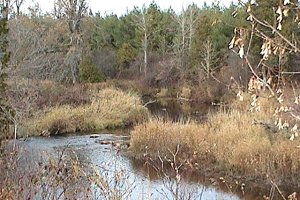 Jock River along McCaffery Trail
Mississippi River Valley Route Directions: From the McCaffery Trail viewing area, follow McCaffery to McLinton Road, about 0.9 km from the Jock River bridge. Turn right or southwest onto McLinton and drive 1.5 km to the next site on this route, the McLinton Road Marsh, between here and the Ashton Station Road.
Return to Mississippi River Valley.
Return to Birding Ottawa Table of Contents.
|