McLINTON ROAD MARSH
Spring: ** Summer: ** Fall: * Winter: **
Independent Directions to this Site: From Highway 417 (The Queensway) take exit 145 (Highway 7). The offramp continues directly as Highway 7. Continue south, the southwest on Highway 7 for 13.8 km to the Ashton Station Road. Turn left or southeast onto it and go 5.4 km to McLinton Road. Turn left or northeast onto it and the marsh begins almost immediately.
Mississippi River Valley Route Directions: From the McCaffery Trail viewing area, follow McCaffery to McLinton Road, about 0.9 km from the Jock River bridge. Turn right or southwest onto McLinton and drive 1.5 km to the McLinton Road Marsh, between here and the Ashton Station Road.
 Map of the McLinton Road Marsh area
Site Description and Birding Information: Cattail marsh and swamp combine here to give a good variety of wetland habitat.
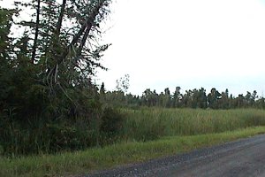 View of McLinton Road Marsh
Mississippi River Valley Route Directions: From the McLinton Road Marsh, go the very short distance southwest to Ashton Station Road and turn left or southeast onto it. Proceed 4.4 km to the Franktown Road (Regional 10). Turn left or north on it and you are at the next site on this route, the Prospect Marsh.
Return to Mississippi River Valley.
Return to Birding Ottawa Table of Contents.
|