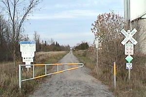
ASHTON STATION TRAILWAY
Spring: ** Summer: ** Fall: ** Winter: *
Independent Directions to this Site: From Highway 417 (The Queensway) take exit 145 (Highway 7). The offramp continues directly as Highway 7. Continue south, then southwest on Highway 7 for 13.8 km to Ashton Station Road. Turn right or northwest onto it and go 0.2 km to the Ashton Station Trailway, just short of Overpass Road.
Mississippi River Valley Route Directions: From the Trail SE of John Kennedy Road, return northwest along John Kennedy Road for 0.1 km to Hamilton Side Road. Turn left or southwest onto it and drive 1.4 km to Golden Line Road. Turn left or southeast onto it and proceed 5.1 km, on what is now Ashton Station Road, to the Ashton Station Trailway, just short of Highway 7.
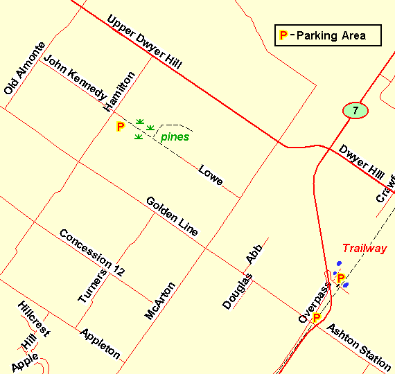 Map of the Ashton Station Trailway area
Site Description and Birding Information: The passing of the railway has left us with some excellent, albeit straight and level, trails. Some wiseacre has labelled them "trailways". This old railbed, between Stittsville and Carleton Place, has the advantage of running through a variety of forested and swampy land and a slightly elevated viewing level. It can be trudged in either direction. From here, it goes 3.0 km northeast to the Dywer Hill Road or 4.1 km to Regional Road 17 to the southwest. Going northeast, check the settling pond on the right just before you reach the overpass.
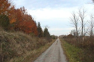
 View of the Trailway Looking East
The Trailway can also be reached by going northeast on Overpass Road, just to the northwest on Golden Line. Follow it about 0.3 km as it goes under Highway 7 and winds back south to the Trailway. There is an old roadway just to the north and parallel to the Trailway that passes a couple of ponds on the left. This may be a better place to park if you plan on heading northeast on the Trailway. There is another pond on the left of the Trailway on Overpass Road, which is gated just short of the Trailway presently; but which is slated to become a through road to the Ashton Station Road.
 View of the Trailway Looking Northeast of Overpass Road
|
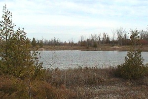 Pond along Trailway at Overpass Road
|
Both Northern Hawk-Owl (Jan. 1989 for some time near the Highway 7 crossing of Overpass Road) and Great Gray owl (Jan. 21, 2005 - less than 2 km south on Ashton Station Road) have been seen near here.
Mississippi River Valley Route Directions: From the Ashton Station Trailway on Ashton Station Road, continue southeast 0.2 km on Ashton Station to Highway 7. Continue southeast across Highway 7 and follow it another 2.3 km southeast to McCaffery Trail. Turn left or east onto it and drive 2.3 km to the Jock River biridge. Begin the next site on this route, the McCaffery Trail, here.
Return to Mississippi River Valley.
Return to Birding Ottawa Table of Contents.
|