APPLETON
Spring: ** Summer: * Fall: ** Winter: *
Independent Directions to this Site: From Highway 417 (The Queensway) take exit 145 (Highway # 7). If driving east, a 0.8 km offramp brings you to right or southeast, then south, onto Highway # 7. If travelling west, the offramp to the right brings you southwest, then south, 1.4 km to meet the eastbound traffic on Highway # 7. From here, both groups will now follow Highway # 7 south, then southwest, 15.9 km to Cemetery Sideroad Road. Turn right or northwest onto Cemetery and follow it for 2.7 km to River Road. Turn left onto River and continue northwest 2.0 km to the T-junction at Lanark 11 on the Mississippi River at Appleton.
Mississippi River Valley Route Directions: From the bridge to Glen Isle, return 0.7 km to Lanark 29 and turn right or north on it. Proceed northwest 0.8 km to Lanark 11 and turn right or northeast onto it. Drive northeast for 2.2 km to the bridge at the centre of the community of Appleton.
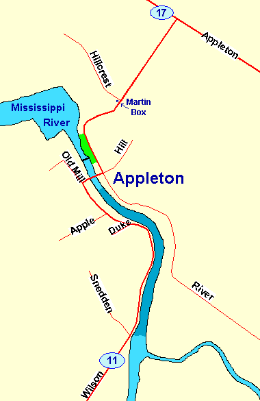 Map of the Appleton area
Site Description and Birding Information: The stretch of the Mississippi River south of Appleton is not only beautiful but has good birding potential. Watch for flocks of swallows in season and patrolling Belted Kingfishers. Lanark County Road 11 closely parallels the river and provides excellent viewing of the portion shown in a darker blue on the map.
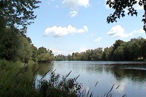 The Mississippi River South of Appleton
The riparian flood zone below the dam (green on map), is an area of flat rock, water, tangles and large trees providing an interesting habitat for migrants. There is parking just above the dam.
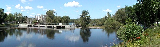 The Dam at Appleton
Watch for Purple Martins, there is an active martin house at the corner of River Road (Lanark 11) and Hillcrest Drive.
Mississippi River Valley Route Directions: From the junction of River Road and Lanark 11 in Appleton, go north on Lanark 11 through the "town" and then east to Lanark 17 (a total of 1.9 km). Turn left and drive northeast for 1.8 km to Hamilton Road. Turn right on Hamilton and proceed 1.5 km to Ramsey Concession 12. Turn left or northwest and go 2.6 km to the junction of Old Almonte Road & Ramsey Concession 12, the next site on this route.
Return to Mississippi River Valley.
Return to Birding Ottawa Table of Contents.
|