GLEN ISLE
Spring: ** Summer: * Fall: ** Winter: *
Independent Directions to this Site: From Highway 417 (The Queensway) take exit 145 (Highway # 7). If driving east, a 0.8 km offramp brings you to right or southeast, then south, onto Highway # 7. If travelling west, the offramp to the right brings you southwest, then south, 1.4 km to meet the eastbound traffic on Highway # 7. From here, both groups will now follow Highway # 7 south, then southwest, 19.6 km to McNeely Avenue. Turn right or northwest onto McNeely and follow it for 2.7 km to Lanark 7B and Lanark 29. Turn right or NNE onto Lanark 29 and drive 2.0 km to the turnoff on the right or east to Glen Isle. Head east on the road to the island for 0.7 km, where you cross the bridge and begin to explore Glen Isle.
Mississippi River Valley Route Directions: From the parking area on the island at Carleton Place, proceed west across the bridge and at 0.1 km turn right or NNE onto Rosamond Street. Go 0.2 km NNE on Rosamond and turn left or northwest on Gemmill Street. Take Gemmill 0.1 km to William Street and turn right or NNE onto it. Follow William NNE for 0.5 km to Town Line East or Lanark 7B & 29 and go straight or NNE onto it. Drive NNE for 2.0 km to the turnoff on the right or east to Glen Isle. Head east on the road to the island for 0.7 km, where you cross the bridge and begin to explore Glen Isle.
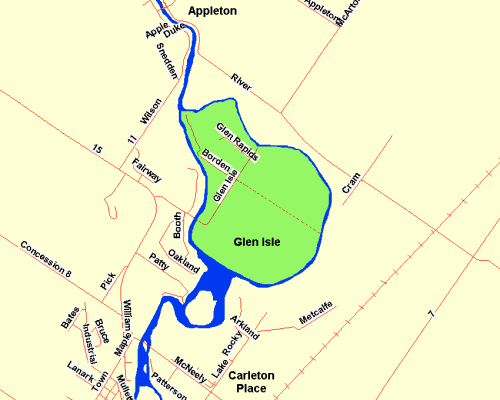 Map of Glen Isle area
Site Description and Birding Information: This island at a bend in the Mississippi River, only 3 km northwest of Carleton Place, was once the site of a few farms. Now it is being slowly given over to privacy-loving riverfront home owners. The stretch of road from the bridge to the junction of Glen Isle Road with Borden would make a lovely walk in early morning during migrations. It passes through some beautiful bottomland and mixed woodland.
It was off the SE side of this island that on Oct. 26, 1993 a hunter shot a Dovekie on the Mississippi River, believing it to be a Bufflehead.
The Mississippi Valley Field Naturalists (MVFN) are based here in Carleton Place. Check there website for more information.
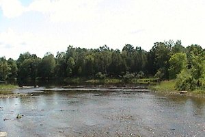 Glen Isle from Bridge
Mississippi River Valley Route Directions: From the bridge to Glen Isle, return 0.7 km to Lanark 29 and turn right or north on it. Proceed northwest 0.8 km to Lanark 11 and turn right or northeast onto it. Drive northeast for 2.2 km to the bridge at the centre of the community of Appleton, our next site.
Return to Mississippi River Valley.
Return to Birding Ottawa Table of Contents.
|