OLD ALMONTE ROAD & RAMSEY CONCESSION 12
Spring: ** Summer: ** Fall: * Winter: *
Independent Directions to this Site: From Highway 417 (The Queensway) take exit 145 (Highway # 7). If driving east, a 0.8 km offramp brings you to right or southeast, then south, onto Highway # 7. If travelling west, the offramp to the right brings you southwest, then south, 1.4 km to meet the eastbound traffic on Highway # 7. From here, both groups will now follow Highway # 7 south, then southwest, 10.5 km to the Upper Dywer Hill Road or Regional 3. Turn right or northwest onto it and follow it for 4.1 km to Hamilton Road. Turn left or southwest onto it and go 4.2 km to Ramsey Concession 12. Turn right or northwest and go 2.6 km to the junction of Old Almonte Road & Ramsey Concession 12.
Mississippi River Valley Route Directions: From the junction of River Road and Lanark 11 in Appleton, go north on Lanark 11 through the "town" and then east to Lanark 17 (a total of 1.9 km). Turn left and drive northeast for 1.8 km to Hamilton Road. Turn right on Hamilton and proceed 1.5 km to Ramsey Concession 12. Turn left or northwest and go 2.6 km to the junction of Old Almonte Road & Ramsey Concession 12.
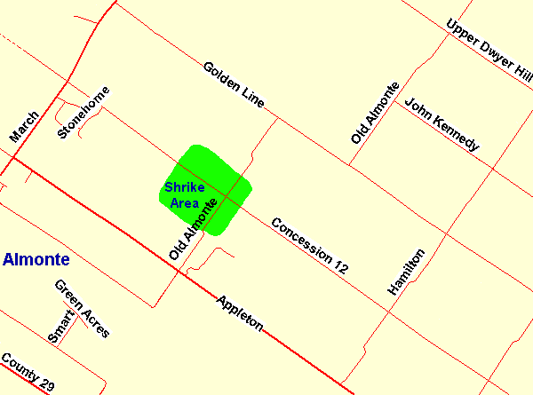 Map of the Old Almonte Road & Ramsey Concession 12 area
Site Description and Birding Information: This site is the locus for one of the more consistent Loggerhead Shrike nesting areas in the Ottawa checklist circle. However, like many similar areas, it has not produced shrike sightings in the immediate past. From the late 80's though the 90's it was one of the better local shrike 'spots'. It is still worth checking as the shrikes move their nest around each year. They may simply be back away from the road and out of sight. One year they nested in a roadside hawthorne near the corner, perhaps they will again.
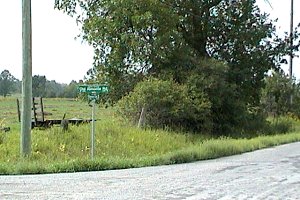 Old Almonte Road & Ramsey Concession 12
Mississippi River Valley Route Directions: From the junction of Old Almonte Road & Ramsey Concession 12, go northwest for 2.8 km on Ramsey Concession 12 to March Road or Regional 49. Turn right and drive northeast 1.8 km to the entrance on the left or northwest to the next site on this route, The Burnt Lands Alvar PNR - SE Block.
Return to Mississippi River Valley.
Return to Birding Ottawa Table of Contents.
|