FOREST EDGE DRIVE TRAIL
Spring: ** Summer: ** Fall: ** Winter: **
Independent Directions to this Site: From Highway 417 (The Queensway) take exit 164 (Panmure Road) to the southwest. Follow Panmure Road 0.4 km to Marchwood Road. Turn left or southeast onto it and proceed 4.4 km to Vaughn Side Road. Turn left or northeast onto Vaughn and proceed 1.2 km to Forest Edge Drive. Turn right or southeast into it and drive the 0.4 km to its end. Park here to explore the Forest Edge Drive Trail.
Mississippi River Valley Route Directions: From the Panmure Road Heronry, proceed 0.5 km to Marchwood Road. Turn right or southeast and follow it 4.4 km to Vaughn Side Road. Turn left or northeast onto Vaughn and proceed 1.2 km to Forest Edge Drive. Turn right or southeast into it and drive the 0.4 km to its end. Park here to explore the Forest Edge Drive Trail.
 Map of the Forest Edge Drive Trail area
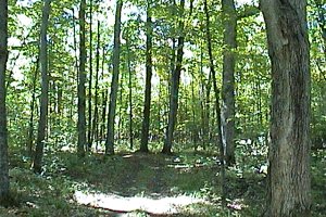
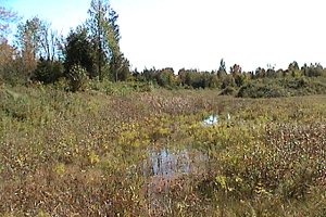
Site Description and Birding Information: This trail is part of the vast winter snowmobile trail network, and clearly sees much use as an off-road vehicle trail in other seasons. That said, it is still a wonderful walking trail that wanders through an excellent variety of habitats. These include second growth deciduous woodland, cedar, maturing deciduous with some large trees interspersed, and overgrown fields. I believe it eventually, after 3 plus kilometres trending southeast, reaches March Road.
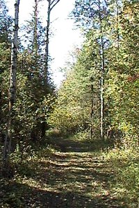
 Forest Edge Drive Trail
Worth also checking is the northwestward extension of this trail. Access it through the old quarry on the north side of Vaughn Side Road about 0.4 km southwest of Forest Edge Drive. The quarry road has been blocked with a gate and debris, but off-roaders have simply gone around this. Follow the road past the quarry and its ponds to the continuation of the snowmobile trail.
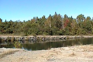
 Quarry Area to the Northwest
Mississippi River Valley Route Directions: From the Forest Edge Drive Trail, return the 0.4 km northwest to Vaughn Side Road. Turn left or southwest onto Vaughn and proceed 2.6 km to Peter Robinson Road. Turn left or southeast onto it and go 1.6 km to our next site, Cody Creek at Peter Robinson Road.
Return to Mississippi River Valley.
Return to Birding Ottawa Table of Contents.
|