PANMURE ROAD HERONRY
Spring: ** Summer: ** Fall: * Winter: *
Independent Directions to this Site: From Highway 417 (The Queensway) take exit 164 (Panmure Road) to the southwest. Follow Panmure Road 0.9 km to the Panmure Road Heronry.
Mississippi River Valley Route Directions: From the corner where Granger Park Road becomes Breezy Heights Road, proceed southeast 3.2 km to Panmure Road. Turn left or northeast onto it and drive 0.5 km to the Panmure Road Heronry.
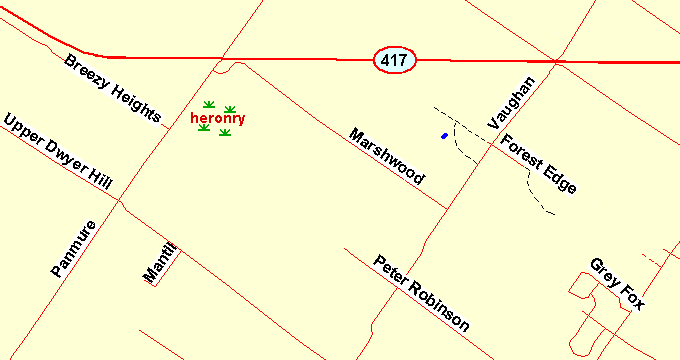 Map of the Panmure Road Heronry area
Site Description and Birding Information: This is one of the easier heronries in our area to view from the road. The major difficulty is parking. The shoulder is narrow and traffic often thick enough to make stopping unsafe. So a short walk may be necessary. About eight nests are visible from the road, in the upper braches of trees in the swamp. During breeding season other swamp denizens can be found here, such as Swamp Sparrow and Green Heron. And the adjacent woodland can produce such species as Northern Waterthrush, Purple Finch, White-throated Sparrow, Rose-breasted Grosbeak, Northern Oriole, etc.
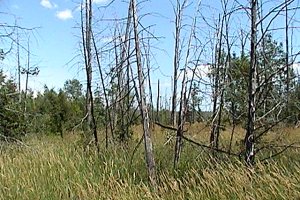
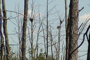 Heronry along Panmure Road
The woods from Breezy Heights Road to the 417, and the 2 km of Panmure Road going northeast beyond the 417, should be checked at night for owls. Best times in March and April, but possible anytime.
Marchwood Road, on the way to the next site, is also worth birding. It is forested for much of its length. A Three-toed Woodpecker spent some of the 1986-87 winter along here.
Not far to the SW on Panmure, at the Upper Dwyer Hill Road, there was a singing Western Meadowlark from July 18 to August 2, 2011.
Mississippi River Valley Route Directions: From the Panmure Road Heronry, proceed 0.5 km to Marchwood Road. Turn right or southeast and follow it 4.4 km to Vaughn Side Road. Turn left or northeast onto Vaughn and proceed 1.2 km to Forest Edge Drive. Turn right or southeast into it and drive the 0.4 km to its end. Park here to explore our next site, the Forest Edge Drive Trail.
Return to Mississippi River Valley.
Return to Birding Ottawa Table of Contents.
|