BREEZY HEIGHTS ROAD
Spring: ** Summer: * Fall: ** Winter: *
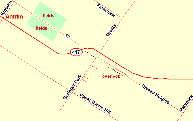
Independent Directions to this Site: From the Highway 417 (The Queensway), take Exit 169 (Kinburn Side Road) and drive southwest 0.7 km to the Upper Dwyer Hill Road. Turn left or southeast on it and proceed 3.0 km to Granger Park Road. Turn left or northeast onto it and go 1.2 km to Breezy Heights Road.
Mississippi River Valley Route Directions: From wherever you are along the stretch of old Highway 17 adjacent the fields just southeast of Antrim, return northwest to the Kinburn Side Road at Antrim. Turn left or southwest onto Kinburn and drive 1.4 km to the Upper Dwyer Hill Road. Turn left or southeast on it and proceed 3.0 km to Granger Park Road. Turn left or northeast onto it and go 1.2 km to Breezy Heights Road.
 Map of the Breezy Heights Road area
Site Description and Birding Information: This site consists of the section of old Highway 17 which is now an extension of Breezy Heights Road, joining it to Granger Park Road. The new section of Highway 417 lies just to the northeast, while to the southwest the view is from Breezy Heights down across the Upper Dywer Hill Road to Cody Creek. The road has excellent wide shoulders for parking along and passes a variety of open, scrubby areas and second-growth woodland, often cedar.
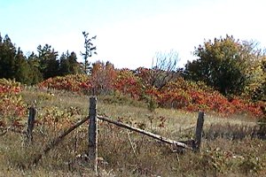 Sumac along Breezy Heights Road
Just before the corner where Granger Park Road turns right to become Breezy Heights Road, there is a wood road on the left or northwest. This extends several hundred metres through the cedar and deciduous woodland before deadending at a large wood pile.
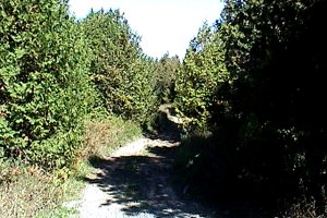 Wood Road to Northwest
The portion of Breezy Heights Road overlooking the valley provides excellent hawk watching opportunities in season.
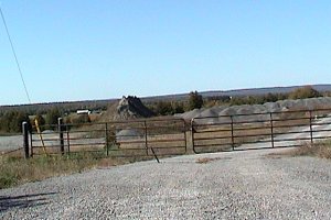 Looking into Valley from Quarry
Mississippi River Valley Route Directions: From the corner where Granger Park Road becomes Breezy Heights Road, proceed southeast 3.2 km to Panmure Road. Turn left or northeast onto it and drive 0.5 km to our next site, the Panmure Road Heronry.
Return to Mississippi River Valley.
Return to Birding Ottawa Table of Contents.
|