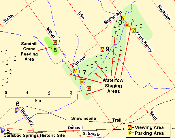
NORTH END of BOUNDARY ROAD
Spring: ** Summer: ** Fall: * Winter: *
Independent Directions to this Site: From Highway 417 (The Queensway) take exit 96 (Boundary Road). Proceed 2.0 km NNW on Boundary Road to Russell Road (Regional 26). Cross it and continue NNW on Boundary Road to its end, an additional 1.8 km.
Mer Bleue - French Hill Loop Route Directions: From the parking lot at the Carlsbad Springs Historic Site turn right or ENE onto Russell Road (Regional 26), and drive 1.4 km to Boundary Road. Turn left or NNW on Boundary Road and go 1.8 km to its end.
 Map of North End of Boundary Road area
Site Description and Birding Information: The snowmobile trail off the end of this road gives access to the southern margin of Mer Bleue. The trail is north of, and roughly parallel to the railway line and runs the length of Mer Bleue (nearly 5 km). Rubber boots are necessary much of the year.
Check the riparian habitat at the bridge over the creek on the way to the road's end.
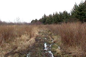 Trail off North End of Boundary Road
Mer Bleue - French Hill Loop Route Directions: From the North End of Boundary Road, return SSE 1.8 km to Russell Road (Regional 26). Turn left or ESE onto Russell and drive 3.0 km to Milton Road (Regional 31). Turn left or NNW on Milton and go about 1.0 km to the top of the hill heading down to Bear Brook - Milton Road, our next site on this loop. Park on the shoulder of the road and after scanning from here move ahead 1.0 km to park near the bridge.
Return to Mer Bleue - French Hill Loop.
Return to Birding Ottawa Table of Contents.
|