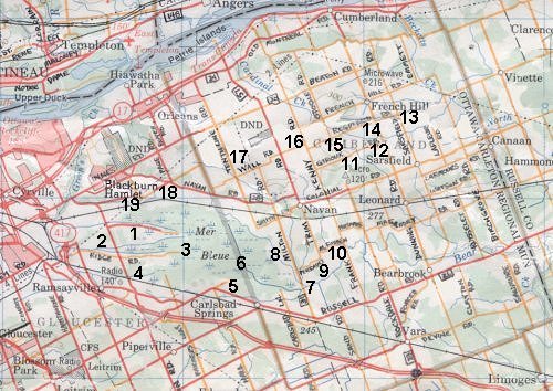
(Click on your choice below or on the map.)
Anderson Road Trails - 2
Mer Bleue Boardwalk & Trail - 3
Ramseyville Marsh - 4
Carlsbad Springs Historic Site - 5
North End of Boundary Road - 6
Bear Brook at Milton Road - 7
Milton Road - 8
Bear Brook at Trim Road - 9
Bear Brook at Frank Kenny Road - 10
Giroux Road Quarry Ponds - 11
Giroux & Dunning Roads - 12
Sarsfield & Regimbald Roads - 13
Dunning & Regimbald Roads - 14
Regimbald & O'Toole Roads - 15
Frank Kenny & Wall Roads - 16
Wall & 10th Line Roads - 17
Renaud Road - 18
Kemp Road - 19
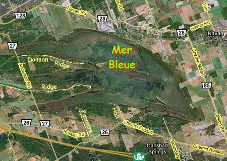
This loop combines three important elements of the Ottawa area ecology. The first is Mer Bleue, the crown jewel of the local greenbelt. Its 2,000 hectares (5,000 acres) of peatland makes it one of the largest in Southern Ontario and unique in the Ottawa area. The second is the area of Bear Brook that floods in spring between Mer Bleue and Frank Kenny Road, east of Carlsbad Springs. And the third is the agricultural land east of Orleans and Blackburn Hamlet. These combine to make this a very rewarding loop.Return to Southeast Routes.
Return to Birding Ottawa Table of Contents.