DROUIN ROAD NORTH OF CLARENCE-CAMBRIDGE BOUNDARY ROAD
Spring: ** Summer: *** Fall: ** Winter: ***
Independent Directions to this Site: From Highway 417, 39 km east of Ottawa, take the Limoges exit (79) and go NNW for 4.4 km on Limoges Road (CR 5), through the town of Limoges to the junction of this road with Regional Roads 8 and 37. Follow the right hand curve on Regional 37 or the Saumure/Clarence-Cambridge Boundary Road northeast for 0.9 km to where Saumure turns left. Then continue straight northeast on the Clarence-Cambridge Boundary Road for an additional 3.7 km to Drouin Road North of Clarence-Cambridge Boundary Road. Turn left or NNW onto Drouin.
Larose Forest Loop Route Directions: From the barracade at the North End of Indian Creek Road, return SSE on Indian Creek Road for 2.6 km to the Clarence-Cambridge Boundary Road. Turn left or northeast on it and go 1.4 km to Drouin Road North of Clarence-Cambridge Boundary Road. Turn left or NNW onto Drouin.
 Map of the Drouin Road North of Clarence-Cambridge Boundary Road Area
Click on other site numbers to go to their pages.
Map of the Drouin Road North of Clarence-Cambridge Boundary Road Area
Click on other site numbers to go to their pages.
Site Description and Birding Information: Drouin Road (sometimes labelled "10") is a dirt road, which is generally a step up from a dirt track, giving access to the northern portion of the Larose Forest. It can be driven, with caution, during drier times of year through to St. Felix Road. There is a good mix of deciduous and coniferous forest with scattered wooded swamplands and a large marsh along the way. About 1.0 km from the Clarence-Cambridge Boundary Road, you will come to the ski trail, and at 1.7 km the ATV trail (Rd 25), and in 3.1 km the St. Felix Road. The area can be quite wet in any season but winter, so boots are recommended in warmer months. Insects can be bothersome at that time too.
The large marsh is found about 1.9 km from the Clarence-Cambridge Boundary Road. An obscurely placed sign at its south end calls it a "Réserve faunique" en français and, interestingly, a "Wildlife Reservoir" in English.
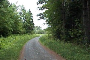 Drouin Road
|
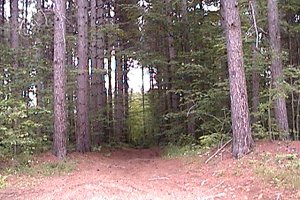 Trail off Drouin Road
|
Larose Forest Loop Directions: From wherever you are on Drouin Road North of Clarence-Cambridge Boundary Road, return SSE on Drouin Road to the Clarence-Cambridge Boundary Road. Turn left or northeast on it and go 1.2 km to the next site on this route, Gagnon Trail South of Clarence-Cambridge Boundary Road. Turn right or SSE to enter the trail.
Return to Larose Forest Loop.
Return to Birding Ottawa Table of Contents.
|