INDIAN CREEK ROAD NORTH END
Spring: ** Summer: *** Fall: ** Winter: ***
Independent Directions to this Site: From Highway 417, 39 km east of Ottawa, take the Limoges exit (79) and go NNW for 4.4 km on Limoges Road (CR 5), through the town of Limoges to the junction of this road with Regional Roads 8 and 37. Follow the right hand curve on Regional 37 or the Saumure/Clarence-Cambridge Boundary Road northeast for 0.9 km to where Saumure turns left. Then continue straight northeast on the Clarence-Cambridge Boundary Road for an additional 2.3 km to Indian Creek (left) and Grant (right) Roads. Turn left or NNW onto Indian Creek and go 2.6 km to the barracade at the Indian Creek Road North End.
Larose Forest Loop Route Directions: From the Pineview Picnic Area, continue straight or NNW on Indian Creek Road for a further 1.6 km to the barracade at the Indian Creek Road North End.
 Map of the Indian Creek Road North End Area
Click on other site numbers to go to their pages.
Map of the Indian Creek Road North End Area
Click on other site numbers to go to their pages.
Site Description and Birding Information: Indian Creek Road passes through a further good variety of habitat on its way to the barricade above Indian Creek, from the Pineview Picnic Area and the JGL Logging Road. An Olive-sided Flycatcher spent at least a week in early June 2008 around the pond at the junction of Indian Creek and JGL Logging Roads. Not far from the barracade is the ATV trail, which traverses the northern section of the forest. And almost at the barracade is another inviting looking trail (see photo below).
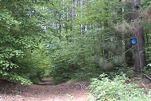 Trail off the North End of Indian Creek Road
If you go beyond the barracade on foot, you can descend to the bridge across South Indian Creek. The creek and the woodlands beside it are good for birding. Mourning Warbler is a breeding bird here, and can be seen from the road near the bridge.
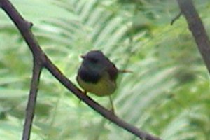 Mourning Warbler at South Indian Creek and Indian Creek Road - June 24, 2005
Larose Forest Loop Directions: From the barracade at the North End of Indian Creek Road, return SSE on Indian Creek Road for 2.6 km to the Clarence-Cambridge Boundary Road. Turn left or northeast on it and go 1.4 km to Drouin Road (10). Turn left or NNW into the next site on this route, Drouin Road North of Clarence-Cambridge Boundary Road.
Return to Larose Forest Loop.
Return to Birding Ottawa Table of Contents.
|