GRANT ROAD SOUTH OF CLARENCE-CAMBRIDGE BOUNDARY ROAD
Spring: ** Summer: *** Fall: ** Winter: ***
Independent Directions to this Site: From Highway 417, 39 km east of Ottawa, take the Limoges exit (79) and go NNW for 4.4 km on Limoges Road (CR 5), through the town of Limoges to the junction of this road with Regional Roads 8 and 37. Follow the right hand curve on Regional 37 or the Saumure/Clarence-Cambridge Boundary Road northeast for 0.9 km to where Saumure turns left. Then continue straight northeast on the Clarence-Cambridge Boundary Road for an additional 2.3 km to Grant (right) and Indian Creek (left) Roads. Turn right or SSE onto Grant to begin birding the Grant Road South of Clarence-Cambridge Boundary Road.
Larose Forest Loop Route Directions: From the Drouin Road from St. Felix Road site there are two alternatives, depending on your vehicle type and risk tolerance. Assuming you take the more conservative approach and have not driven through to the Clarence-Cambridge Boundary Road (see next paragraph if you have), begin by returning to the junction of Drouin and St. Felix Roads. From there continue straight or NNW on Drouin for 1.5 km to Russell Road (Regional 26). Turn left or southwest on Russell and drive 3.6 km to Saumure Road (Regional 37). Turn left or SSE into Saumure and go 4.6 km to the Clarence-Cambridge Boundary Road. Turn left yet again or northeast onto the Clarence-Cambridge Boundary Road and proceed 2.3 km to Grant (right) and Indian Creek (left) Roads. Turn right or SSE onto Grant to begin birding the Grant Road South of Clarence-Cambridge Boundary Road.
Follow these directions if you were able to drive through to the Clarence-Cambridge Boundary Road on Drouin: When you reach the Clarence-Cambridge Boundary Road, 3.1 km from St. Felix Road, turn right or southwest onto the Clarence-Cambridge Boundary Road and proceed 1.4 km to Grant (left) and Indian Creek (right) Roads. Turn left or SSE onto Grant to begin birding the Grant Road South of Clarence-Cambridge Boundary Road.
 Map of the Grant Road South of Clarence-Cambridge Boundary Road area
Click on other site numbers to go to their pages.
Map of the Grant Road South of Clarence-Cambridge Boundary Road area
Click on other site numbers to go to their pages.
Site Description and Birding Information: Grant Road runs 1.8 km SSE from the Clarence-Cambridge Boundary Road, passing through a good variety of habitat, including some large stands of mature pines. It can be driven, with caution, during drier times of year, through to its T-junction with Route 100W. Route 100W is part of the Eastern Ontario Snowmobile Trail, running between Casselman (to the east) and Limoges (to the west). It is not in as good condition as Grant Road. Much of the Grant Road and Route 100W areas can be quite wet in any season but winter, so boots are recommended in warmer months. Insects can be bothersome at that time too. A walking loop of 8.5 km can be done using Grant Road, Route 100W, the Gagnon Trail and the Clarence-Cambridge Boundary Road.
 Route 100W Looking ENE from Grant Road
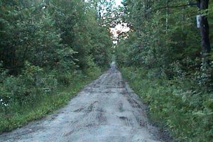
The ghost of the small community of Grant is most easily noted by the presence of the small graveyard at 0.5 km. A sign on the cemetery fence tells the story: "This is where the church once stood in the community of Grant. The grave stones in the cemetery beyond remind us of those who tried in vain to farm this land over one hundred years ago. With the original pine forest cleared for farming, the wind easily eroded the sandy soil, and with it the community of Grant. The school was not far from here. Only the foundation remains." There is space for parking here amidst the pines, with trails in several directions. Barred Owls can often be heard from here, sometimes even after sunup.
 Grant Cemetery
|
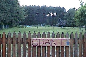
 Mature Pine Plantation across from Grant Cemetery
|
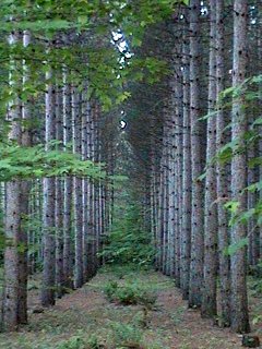
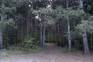 Trail Through Pines at the Grant Cemetery
|
Larose Forest Loop Directions: From the junction of Clarence-Cambridge Boundary and Grant Roads, continue straight or NNW on what is now Indian Creek Road for 1.0 km to the next site on this route, the Pineview Picnic Area.
Return to Larose Forest Loop.
Return to Birding Ottawa Table of Contents.
|