CHEMIN CRÉGHEUR
Spring: * Summer: ** Fall: ** Winter: **
Independent Directions to this Site: From Boulevard des Allumettières or Highway 148, take the Chemin Eardley exit in Aylmer. Turn right or northwest onto Chemin Eardley or the continuation of Highway 148 and proceed 12.3 km northwest on Eardley to Chemin Crégheur. Turn right or north onto Chemin Crégheur and drive 1.8 km north to where there is open farmland on both sides of the road.
Eardley Escarpment & Gatineau Park Northwest Route Directions: From Lac des Montagnes on Chemin Hollowglen, continue north 0.5 km to Chemin de la Montagnes (Mountain Road). Turn left or northwest onto de la Montagnes and drive 6.0 km to Chemin Crégheur. Turn right and drive 0.8 km north to where there is open farmland on both sides of the next site on this route, Chemin Crégheur.
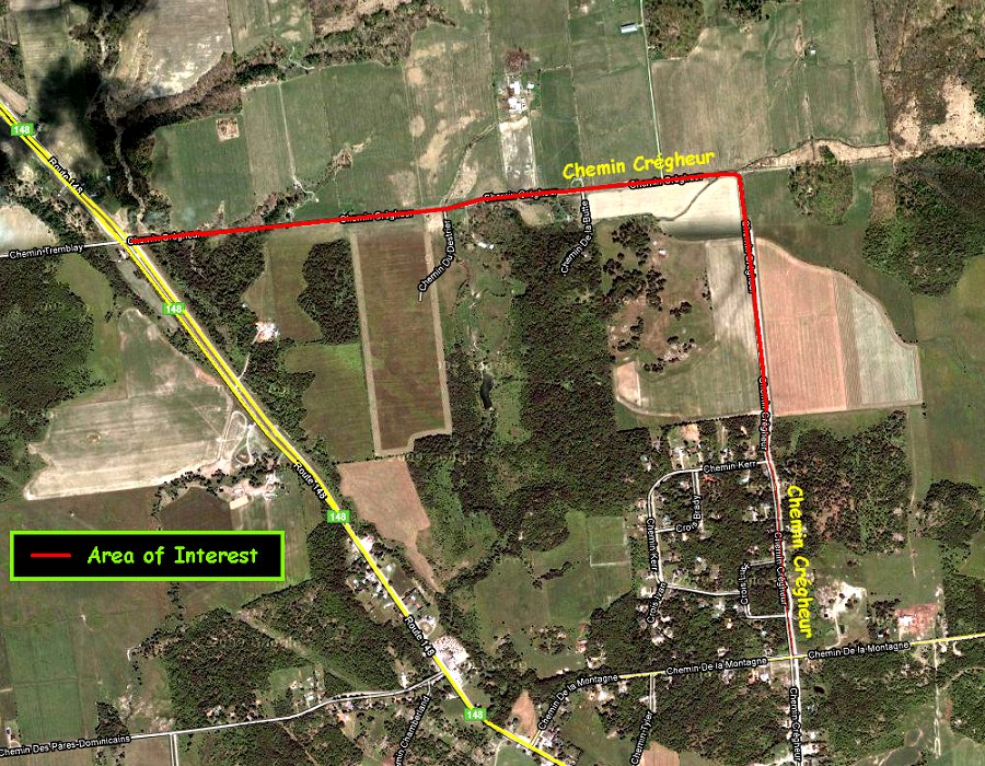 Google Satellite Image Map of the Chemin Crégheur Area
Site Description and Birding Information: Drive this road checking the farmland for field birds.
Eardley Escarpment & Gatineau Park Northwest Route Directions: From the western end of Chemin Crégheur at Highway 148, turn right or northwest and drive 2.2 km to Chemin de l'Hôtel-de-Ville. Turn right or ENE onto de l'Hôtel-de-Ville and drive 0.7 km to the road on the left into Luskville Falls. Turn left or north and proceed 0.3 km to the parking area for the next site on this route, the Luskville Falls Trail.
Return to Eardley Escarpment & Gatineau Park Northwest.
Return to Birding Ottawa Table of Contents.
|