LAC DES MONTAGNES
Spring: ** Summer: * Fall: ** Winter: *
Independent Directions to this Site: From Boulevard des Allumettières or Highway 148, take the Chemin Eardley exit in Aylmer. Turn right or northwest onto Chemin Eardley or the continuation of Highway 148 and proceed 3.6 km northwest to Chemin Terry-Fox. Turn right or north onto Terry-Fox and go 4.1 km to Chemin Baillie (Baillie Road). Turn right or east onto Baillie and go 2.0 km to Chemin Daly. Turn left or north on Daly and drive 1.7 km to Chemin Kelly. Turn right or east onto Kelly and go 0.7 km to the east end of Lac des Montagnes.
Eardley Escarpment & Gatineau Park Northwest Route Directions: From the Chemin Baillie (Baillie Road) Gully, return east 1.7 km on Chemin Baillie to Chemin Daly. Turn left or north on Daly and drive 1.7 km to Chemin Kelly. Turn right or east onto Kelly and go 0.7 km to the east end of the next site on this route, Lac des Montagnes.
 Google Satellite Image Map of the Lac des Montagnes Area
Site Description and Birding Information: This lake extends about two kilometers along the escarpment, roughly parallel and south of Chemin de la Montagnes (Mountain Road). It is heavily cottagized or suburbanized and consequently is of little interest in summer. But like any body of water, it can attract waterfowl during migration and until frozen in winter.
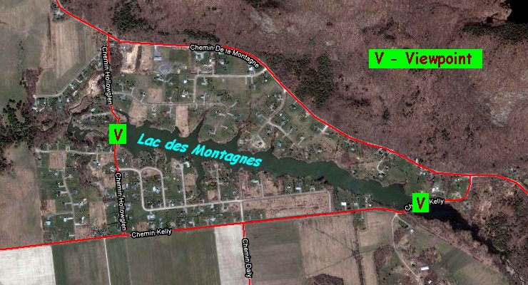
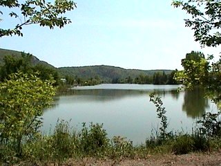
 Looking WNW from the Chemin Kelly Crossing
|
|
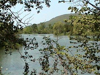
 Looking ESE from the Chemin Kelly Crossing
|
Views for checking the lake can be had from both the eastern end where Chemin Kelly crosses the lake to join Mountain Road, or from the west end where Chemin Hollowglen crosses of the lake. Both east of Kelly and west of Hollowglen there are marshy areas worth checking. To reach Chemin Hollowglen, return the 0.7 km on Kelly to Chemin Daly and continue on Kelly a further 0.5 km to Hollowglen. Turn right on Hollowglen and go 0.5 km to the lake.
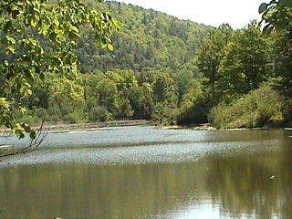
 Looking West from the Chemin Hollowglen Crossing
|
|
 Looking East from the Chemin Hollowglen Crossing
|
Alternately, you may go from one end of the lake to the other on Chemin de la Montagnes (Mountain Road). If so you will skirt the escarpment and creekbeds dropping into the lake.
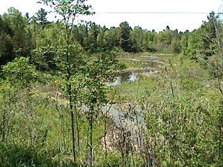
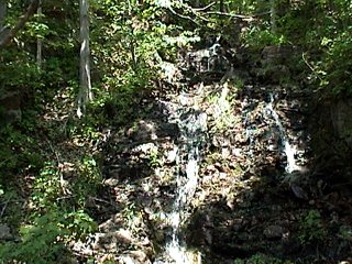 Creek Coming Down the Escarpment along Chemin de la Montagnes (Mountain Road)
Eardley Escarpment & Gatineau Park Northwest Route Directions: From Lac des Montagnes on Chemin Hollowglen, continue north 0.5 km to Chemin de la Montagnes (Mountain Road). Turn left or northwest onto de la Montagnes and drive 6.0 km to Chemin Crégheur. Turn right and drive 0.8 km north to where there is open farmland on both sides of the next site on this route, Chemin Crégheur.
Return to Eardley Escarpment & Gatineau Park Northwest.
Return to Birding Ottawa Table of Contents.
|