PINE GROVE TRAILS (DAVIDSON ROAD)
Spring: *** Summer: ** Fall: ** Winter: **
Independent Directions to this Site: From Highway 417 (The Queensway) take exit 110 (Walkley Road). Go southwest on Walkley for 1.3 km to Hawthorne Road. Turn left or SSE onto Hawthorne and proceed 4.3 km to Davidson Road. Turn right or southwest onto it and go 0.4 km to the parking lot, on the left or south side of the road, for the Pine Grove Trails (Davidson Road).
Airport Loop Route Directions: From the parking lot for the Leitrim Road East Trails, turn left or northeast onto Leitrim Road and proceed 0.7 km to Ramseyville (Baseline) Road. Turn left or NNW onto it and follow it 2.0 km to Whyteside Road. Turn left or southwest onto Whyteside and go 2.0 km to Hawthorne Road. Turn left or SSE onto it and drive 0.1 km to Davidson Road. Turn right or southwest onto it and go 0.4 km to the parking lot, on the left or south side of the road, for the Pine Grove Trails (Davidson Road).
 Map of Pine Grove Trails (Davidson Road)
Site Description and Birding Information: This portion of the Pine Grove Forest Reserve section of the "Greeenbelt" has 7.3 kilometres of trails on either side of Davidson Road, between Hawthorne and Conroy Roads. The habitat consists of natural and planted forest, managed for lumber production. These trails (Trails 45 & 46) ultimately join up with those from the previous site, Letrim Road East Trails, if you cross Hawthorne Road to Trail 45. There are basically two loops, Trail 44 to the south of Davidson Road and Trail 43 to the north. Trail 43, a 4 km loop, is also a Forestry Interpretation Trail. Trail 44 is a 3.3 km loop, which can be quite wet in spring. These hiking and cross-country ski trails have year-round parking.
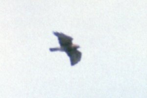
 Broad-winged Hawk at Pine Grove Trails - Apr. 29, 1992
Just southeast of the parking area is a feeding station maintained by the Ottawa Field-Naturalists' Club. Take the main trail (43) southeast from the parking lot and go 50 metres or so to the first main junction (43 & 44). Then take the lefthand trail, which leads eventually to Hawthorne Road, watching for the feeding station on the left around 50 metres in.
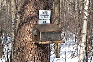 OFNC Feeder at Davidson Road
Airport Loop Route Directions: From the parking lot for the Pine Grove Trails (Davidson Road), turn left or southwest onto Davidson Road and proceed 1.6 km to Conroy Road. Turn left or SSE onto it and drive 1.3 km to Bank Street or Regional Road 31. Turn right or northwest onto it and go c. 0.2 km to the parking lot, on the left or south side of the road, for the next site on this route, NCC Golf Course Trails.
Return to Airport Loop.
Return to Birding Ottawa Table of Contents.
|