ALERT ROAD
Spring: ** Summer: *** Fall: ** Winter: **
Independent Directions to this Site: From Highway 417 (The Queensway) take exit 121A (Bronson Avenue). Avoid doing this during rushhour! Proceed SSE on Bronson 2.6 km to cross the Rideau River via the Dunbar Bridge. Continue straight, SSE on what is now the Airport Parkway for another 6.8 km to the turnoff on the right for Uplands Drive. Follow the 0.3 km exit ramp SSW to Uplands and turn left or east on it. Go 0.3 km and turn into Alert Road on the right or southeast.
Airport Loop Route Directions: From the parking lot for the Pine Grove Park (Conroy Pit), turn right or SSE onto Conroy Road or Regional Road 125 and proceed 2.1 km to Davidson Road. Turn right or southwest onto Davidson and go 1.0 km to Bank Street. Cross Bank Street onto Lester Road and follow Lester southwest for 2.9 km to Alert Road. Turn left or southeast into Alert Road.
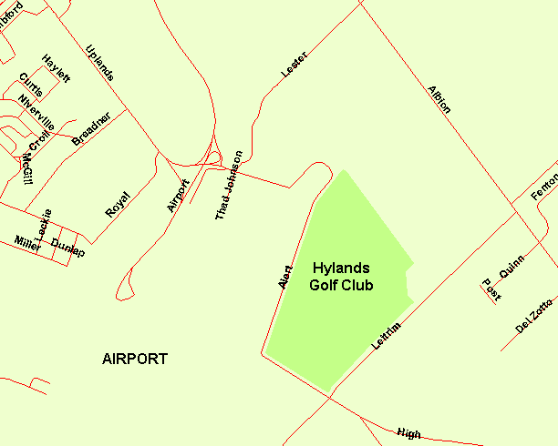 Map of Alert Road Area
Site Description and Birding Information: This is one of the best stretches of road from which to observe the grounds of the airport. Alert Road follows the perimeter fencing around the east side of the airport. Along the southern portion, the Hylands Golf Club is on the eastern side of the roadway. Grasshopper Sparrow can be found at several spots along the fence line. Gray Partridge are sometimes seen on the airport grounds, especially around the mounded storage tanks near the south end. Upland Sandpiper have been found here in breeding season. At the 2.6 km mark Alert Road makes a sharp left turn and becomes for the next 0.6 km, High Road; an extension of the broken road to the south. At its meeting with Leitrim Road, it is blocked off to through traffic, forcing a return to Uplands And Lester 3.2 km to the north.
An adult male Scissor-tailed Flycatcher was seen along the fence at the airport opposite the Hylands Golf Club on August 7, 2005. For some years a pair of Northern Mockingbirds nested near the corner of Alert and Thad Johnson Roads, near the northern end of Alert.
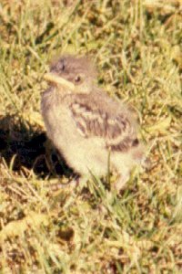 Young Northern Mockingbird
Airport Loop Route Directions: This was the last site on this loop tour. To return to the Queensway (Hwy. 417), drive 0.2 km north along the entry ramp to the Airport Parkway from the corner of Alert Raod with Lester Road and Uplands Drive. Then proceed 6.8 km NNW on the Airport Parkway to the Dunbar Bridge where it becomes Bronson Avenue. Continue straight, NNW for another 2.6 km along Bronson to Highway 417 (exit 121A).
Return to Airport Loop.
Return to Birding Ottawa Table of Contents.
|