PINE GROVE PARK (CONROY PIT)
Spring: ** Summer: ** Fall: ** Winter: **
Independent Directions to this Site: From Highway 417 (The Queensway) take exit 110 (Walkley Road). Go southwest on Walkley for 3.3 km to Conroy Road. Turn left or SSE onto Conroy and proceed 2.7 km to the parking lot, on the right or southwest side of the road, for Pine Grove Park (Conroy Pit).
Airport Loop Route Directions: From the parking lot for the NCC Golf Course Trails, turn right or southeast onto Bank Street or Regional Road 31 and proceed 0.3 km to Conroy Road. Turn left or NNW onto it and go 3.0 km to the parking area, on the left or southwest, for Pine Grove Park (Conroy Pit).
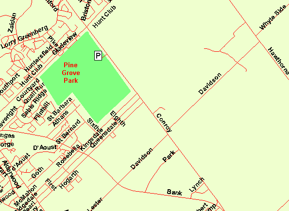 Map of Pine Grove Park (Conroy Pit)
Site Description and Birding Information: The attraction here is network of trails criss-crossing this old quarry site that is now Pine Grove Park. A good variety of field, scrub and wooded habitat exists here. A good variety of our breeding birds have been found here in summer, including Spotted Sandpiper, Ruby-throated Hummingbird, Least Flycatcher, Eastern Bluebird, Brown Thrasher, Field Sparrow, Northern Oriole and Bobolink.
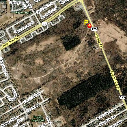 Google Satellite View of Pine Grove Park (Conroy Pit)
Airport Loop Route Directions: From the parking lot for the Pine Grove Park (Conroy Pit), turn right or SSE onto Conroy Road or Regional Road 125 and proceed 2.1 km to Davidson Road. Turn right or southwest onto Davidson and go 1.0 km to Bank Street. Cross Bank Street onto Lester Road and follow Lester southwest for 2.9 km to Alert Road. Turn left or southeast into the last site on this route, Alert Road.
Return to Airport Loop.
Return to Birding Ottawa Table of Contents.
|