Independent Directions to this Site: From Highway 417 (The Queensway) take exit 134 (Moodie Drive). If driving east, a 0.3 km offramp dumps you right or north onto Moodie. If travelling west, the 0.3 km offramp brings you to Moodie Drive, where you will turn left or SSE onto it and in 0.5 km join the eastbound offramp traffic. Both groups will now follow Moodie Drive SSE 1.0 km from here to Timm Drive. Turn right or WSW into Timm Drive.
Stony Swamp Loop Route Directions: From the WSW end of Corkstown Road turn left or SSE onto Eagleson Road. Proceed 1.4 km SSE on Eagleson Road to Timm Drive. Turn left or east onto Timm Drive and go 1.5 km to a parking lot on the right just before Haanel Drive. Park here to hike the Timm Drive & Trails.
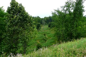
Site Description and Birding Information: It is worth driving the length of this road, especially in winter, when northern owls and Bohemian Waxwings are a possibilities. A variety of habitats occur along the road. It goes through corn fields at the southwest end, watch for geese and blackbird flocks. Then it goes up onto the less productive, agriculturally, greenbelt area, where there are abandonned farms, still showing some overgrown field areas amidst the cedar and scrub. There are deciduous woodlands all along this upper section. Then it goes down toward Bells Corners at its northeast end, where there are cleared fields backed by woodland and cut by deep gullies. Good hunting grounds for raptors. On May 16, 2007 Whooping Crane 309 (the wanderer), enroute from Florida to Wisconsin, was seen three fields west of Moodie Drive.
 |
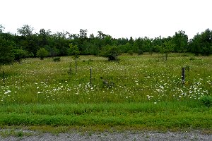 |
There are three loop trails at this site. Two begin at the parking lot (P4), a 2.4 km loop (Trail # 22) to the southwest and a 2.3 km loop (Trail # 21) to the northeast (across Haanel Drive). The third loop (Trail # 20) is on the other side of Timm Drive, to the north. It is accessible from the far end of the northeast loop, or directly from along Timm Drive, though parking is a problem there. It is a 3.0 km loop, which goes northwest to the Queensway (Hwy 417). The eastern side of the loop doubles as a segment of the Greenbelt Pathway West. The beginning sections of the northeast 2.3 km loop (Trail # 21) usually have active feeders during the winter. On May 25, 2010 two or three Olive-sided Flycatchers were seen along a Timm Road trail.
Stony Swamp Loop Route Directions: From the parking lot (P4) for the Timm Drive Trails, turn right or northeast onto Timm Drive and in 0.1 km turn right or SSE onto Haanel Drive. Proceed 0.7 km to Robertson Road or Ottawa-Carleton Regional Road # 36 and turn right or southwest onto it. Drive 1.5 km to Eagleson Road and turn left or SSE onto it. Go 0.3 km SSE on Eagleson to the parking lot, on the left, for the next site in this loop, the Old Quarry Trail.