Independent Directions to this Site: From Highway 416 take exit 66 (Fallowfield Road). If northbound, the 0.4 km offramp brings you to Fallowfield, where you will turn right or east onto it. If southbound, a 0.4 km offramp dumps onto Fallowfield, where you will turn left or east and in 0.5 km join the northbound offramp traffic. Both groups will now follow Fallowfield Road east for an additional 0.4 km to reach Strandherd Drive. Continue straight east onto Strandherd and follow it 2.2 km to Cedarview Road. Turn right or SSE onto Cedarview and drive 1.9 km SSE to Cambrian Road. Park near the corner at the junction of Cambrian & Cedarview Roads.
Stony Swamp Loop Route Directions: From the Nepean Dump, return to Trail Road and turn left or southwest onto it. Proceed 2.2 km on Trail as it winds out to Barnsdale Road. Turn left or ENE on Barnsdale and go 0.4 km, crossing Highway 416 to reach Cedarview Road. Turn left onto it and go 2.1 km to Cambrian Road. Park near the corner at the junction of Cambrian & Cedarview Roads.
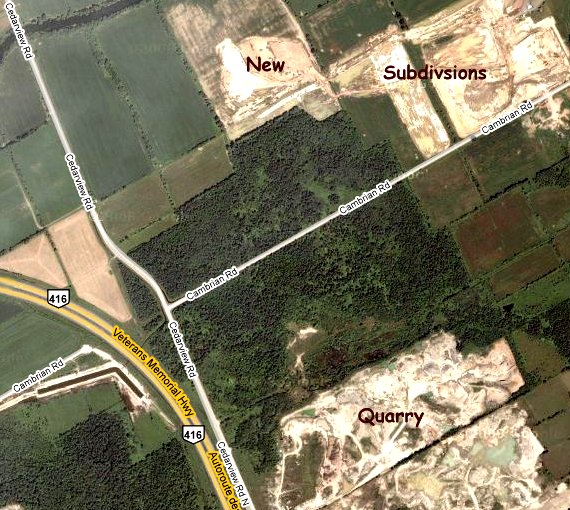
Site Description and Birding Information: This area has been a favorite owling locale for many years. The construction of Highway 416 has disrupted much of the habitat to the west side of Cedarview. Prior to that time, the woodland on the west side of Cedarview and south of Cambrian was one of the best spots to find Eastern Screech-Owl. The birds are likely still nearby, but traffic noise makes hearing them more difficult. The woodlands along Cambrian Road east of the junction are good for Northern Saw-whet Owl.
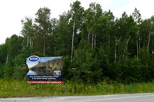
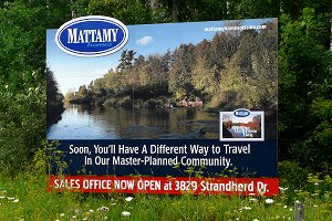
This site appears to be doomed as a birding spot. Subdivisions are being thrown in to the north and east as fast as possible and an ominous sign stands on the corner of Cedarview and Cambrian announcing a "master-planned community". Maybe, just maybe, they will save the woods; but I doubt it.
Stony Swamp Loop Route Directions: From the junction of Cambrian & Cedarview Roads, go ENE on Cambrian for 2.0 km to Greenbank Road. Turn left or NNW onto Greenbank and proceed 0.7 km to the Jock River bridge. Park just south of the bridge at the Half Moon Bay picnic area to explore the next site on this loop, the Jock River Conservation Area.