CLARKE BELLINGER ENVIRONMENTAL FACILITY
Spring: ** Summer: ** Fall: ** Winter: **
Independent Directions to this Site: From Highway 417 (The Queensway) take exit 126 (Maitland Avenue). Eastbound traffic exit right, take the 0.2 km offramp to Maitland Avenue, then turn right or SSE. Westbound traffic exit right, take the 0.2 km offramp to Maitland Avenue, then turn left or SSE onto it and in 0.2 km join the eastbound traffic. Both streams now head SSE on Maitland 1.2 km to where it becomes Clyde Avenue. Continue straight another 0.7 km SSE on Clyde to where it becomes Merivale Avenue. Continue straight on Merivale for an additional 6.9 km to Leikin Drive. Turn right or southwest on Leikin and drive 1.1 km to park along the roadway for the Clarke Bellinger Environmental Facility area.
Rideau River West Side Route Directions: From the Black Rapids area, return to Prince of Wales Drive and turn left or south on it. Drive 2.8 km south to Merivale Road and turn right or west onto it and go 0.3 km NNW to Beckstead Road. Turn left or WSW onto it and drive 0.2 km to Leikin Drive. Turn left or south on Leikin and proceed 0.7 km to park along the roadway for the Clarke Bellinger Environmental Facility area.
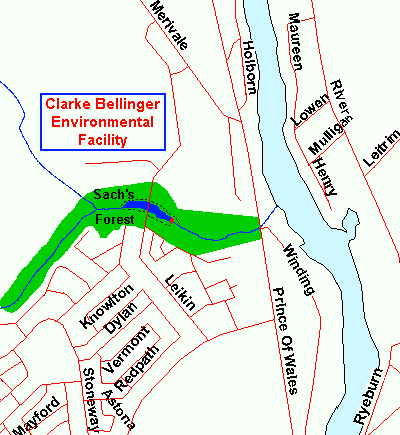 Map of the Clarke Bellinger Environmental Facility area
Site Description and Birding Information: What was formerly Sach's Forest and/or Kennedey-Craig Forest, then the Davidson-Longfield Storm Water Overflow Facility, as the subdivisions encroached; has finally been given the somewhat questionable name of the Clarke Bellinger Environmental Facility. This redefined ravine was, though probably no more, home to nesting Red-headed Woodpeckers. The ponds on either side of the roadway produce some waterfowl and shorebirds, and may become more interesting as time passes and the plantings around the pond become more attractive to birds. The woods in the ravine at both ends of the pond are good for local breeding birds.
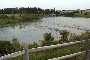 Upper Pond at the Clarke Bellinger Environmental Facility
|
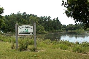 Lower Pond at the Clarke Bellinger Environmental Facility
|
Rideau River West Side Route Directions: From the Clarke Bellinger Environmental Facility area, return along Lakin Drive 0.7 km to Blackstead Road and turn right or northeast onto it. Go 0.2 km northeast to Merivale Road and turn right or SSW onto it. Drive 0.3 km to Prince of Wales Drive and turn right or south onto it. Proceed 1.8 km to Winding Way and turn left into it. Immediately after entering Winding Way turn right into the parking lot for the Chapman Mills Conservation Area, the next site on this route.
Return to Rideau River West Side.
Return to Birding Ottawa Table of Contents.
|