NEPEAN CREEK STORMWATER FACILITY
Spring: ** Summer: ** Fall: ** Winter: **
Independent Directions to this Site: From Highway 417 (The Queensway) take exit 121A to Bronson Avenue. Avoid doing this during rushhour! Proceed SSE on Bronson 0.4 km to Carling Avenue and turn right or southwest onto it. Proceed 0.6 km to Preston Street and turn left or south onto it. Drive 0.1 km to the T-junction and turn right or southwest onto Prince of Wales Drive. Go 5.9 km to Colonnade Road and turn right or WSW on it. Go 150 metres to a T-junction and turn right again, still on Colonnade Road. Drive about 1.0 km to a parking area on the right for the Nepean Creek Stormwater Facility site.
Rideau River West Side Route Directions: From the Moffatt Farm parking area, return to Prince of Wales Drive and turn left or SSW onto it. Proceed 1.5 km to Colonnade Road and turn right or WSW on it. Go 150 metres to a T-junction and turn right again, still on Colonnade Road. Drive about 1.0 km to a parking area on the right for the Nepean Creek Stormwater Facility site.
Site Description and Birding Information: Yet another site under the gun in the name of development! Yet another site up for sale by the National Capital Commission (those intrusted with the preservation of our natural areas in and around Ottawa)! In order to better develope this "dangerously natural" area, the Nepean Creek (which runs through the site) has been tamed to serve as a stormwater overflow area. The adjacent fields, home presently to a flock of 15 or so Gray Partridge, are on the block as an industrial park. Even so, this area still has good birding potential. And the new semi-circular collection of ponds at the east end, with its attendant newly planted "slope-control" vegetation, may attract some birds in the future.
A paved trail follows Nepean Creek in either direction from the parking lot. Follow it to the right or east. There are some damned ponds along the creek here also. You will shortly leave the sterile, groomed section and step into some scrubby woods. Nepean Creek is on the left and has some rather marshy meanders before reaching the eastern ponds. The path curves around the inside edges of the ponds and thence across the fields to Colonnade Road. These fields are Gray Partridge habitat at present, but unfortunately, not for long.
Just to prove industrial parks are not ALL bad, a Northern Wheatear showed up along Colonnade Road near here on May 12, 1986. The Gray Partridge too are sometimes seen along Colonnade, sheltering in the lee of a building.
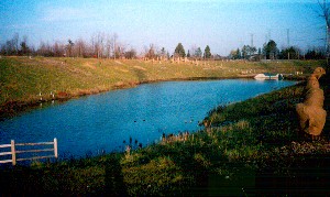 Newly Landscaped Pond at the Nepean Creek Stormwater Facility
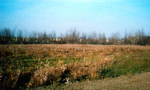 The Gray Partridge Flock Hangs Out Here
Rideau River West Side Route Directions: From the Nepean Creek Stormwater Facility parking area, return to Colonnade Road and turn left or east on it. Drive about 1.0 km on Colonnade to the T-junction and turn left or east and proceed 150 metres to Prince of Wales Drive. Turn right or south onto it and go 2.9 km to Blazer (formerly Sheridan) Avenue. Turn right into Blazer and enter the next site on this route, the Clearview Feeders area.
Return to Rideau River West Side.
Return to Birding Ottawa Table of Contents.
|
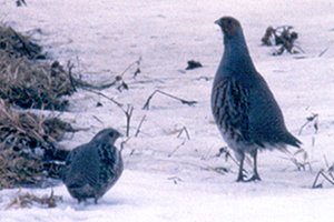 Gray Partridge
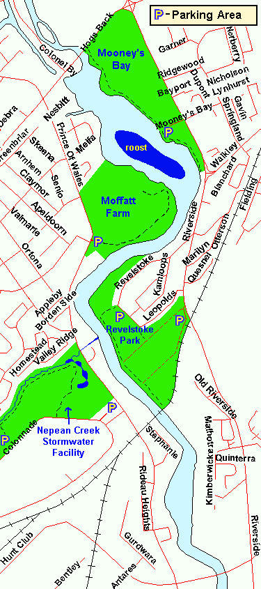 Map of Nepean Creek Stormwater Facility area
|