MOONEY'S BAY
Spring: ** Summer: * Fall: ** Winter: **
Independent Directions to this Site: From Highway 417 (The Queensway) take exit 121A (Bronson Avenue). Go SSE on Bronson for 3.6 km, crossing the Rideau River on the Dunbar Bridge and going over Riverside Drive, before bearing right to take the Brookfield Road exit. In 0.1 km merge right onto Brookfield Road and drive 0.5 km to Riverside Drive. Turn left onto Riverside Drive and go 0.6 km to Ridgewood Avenue. Turn right or west here into the parking area for Mooney's Bay.
Rideau River East Side Route Directions: From Hog's Back Park parking area, return to Hog's Back Road. Turn left or east on it and return 0.3 km to Riverside Drive. Turn right or south onto it and go south 0.6 km to Ridgewood Avenue. Turn right or west here into the parking area for Mooney's Bay.
Site Description and Birding Information: This site is a popular beach area in the summer months, avoid it then as the birds do. The main birding attraction here is the shoals in the bay (really just a widening of the Rideau River). These attract a fair number of roosting gulls.
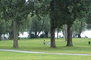 View of Mooney's Bay Park
Rideau River East Side Route Directions: From Mooney's Bay parking area, return to Riverside Drive. Turn right or south on it and proceed 1.9 km to a segment of the old Riverside Drive on the right or west just before the railway overpass. Turn right or west onto this old roadbed and park at the end of its 0.3 km length. This is the next site on this route, Revelstoke Park & Area.
Return to Rideau River East Side.
Return to Birding Ottawa Table of Contents.
|
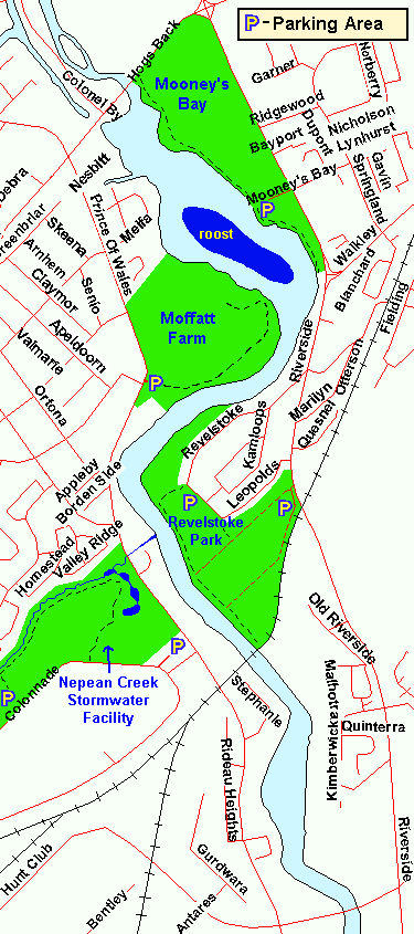 Map of Mooney's Bay
|