SOUTH GOWER BOUNDARY ROAD
(Sod and Turf Farms)
Spring: ** Summer: *** Fall: *** Winter: **
Independent Directions to this Site: From Highway 416 take exit 40 (River Road). Loop around to River Road or Regional 19 and go right or northeast on it for 3.3 km to South Gower Boundary Road. Turn right of south on it and go 1.0 km to the first of the South Gower Boundary Road sod and turf farms.
Rideau River East Side Route Directions: From the parking lot for Gideon Adams Park, return to River Road or Regional 19. Turn right or south onto it and proceed 1.3 km to South Gower Boundary Road. Turn left of south on it and go 1.0 km to the first of the South Gower Boundary Road sod and turf farms.
 Map of South Gower Boundary Road Area
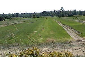
Site Description and Birding Information: For nearly 4 km after you reach the first of the sod farm fields, South Gower Boundary Road is lined by this unique habitat, sometimes on both sides. Both River Road and Arcand Road also have turf farm fields. See map for 2003 field locations, but be aware they may change from year to year.
Gulls are attracted to the freshly cultivated and harvested fields and often use the grassy sections for roosting. Killdeer are common breeders and Upland Sandpipers (sometimes in good numbers) use the grassy fields in August to fatten up for the journey south. Other shorebirds can be seen in late summer and early fall as they pass through our area. It is an especially good site for upland shorebirds, such as Black-bellied Plover, American Golden-Plover and the rare Buff-breasted Sandpiper and Whimbrel.
Fields may be in any state; freshly cultivated, freshly seeded, lawn-like green, partly stripped or fully harvested. Each state attracts birds. As well, watch for recent or on-going irrigation. Water, especially when conditions are dry, often attracts good numbers of birds. Spraying water may attract flocks of swallows, while standing water should be checked for shorebirds and herons.
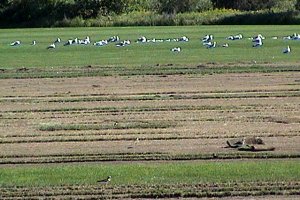 Gulls Resting on River Road Turf Farm
|
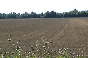 Recently Cultivated Field along Boundary Road
|
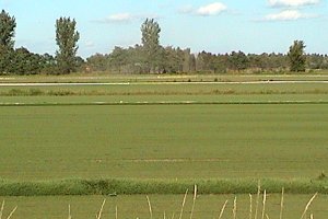
Be aware that when drainage parallels the road, you may not be able to see into the hollows; whereas they are easily viewed when ditching is perpendicular to the road. Even large shorebirds such as Greater Yellowlegs can easily disappear for long periods while feeding in the dips. Patience is sometimes rewarded. Alternately, you could deke down one of the field lanes and scan down the hollows from the sides. Remember to ask permission to use private roads. Avoid fields being currently worked.
This site is also the first site in the South Gower / Mountain Loop. Here you might wish to veer off on the South Gower / Mountain Loop rather than continue south on the Rideau River East Side tour. To do so, go to the next site on South Gower / Mountain Loop, the East End of French Settlement Road.
 Drainage Parallel to Road
|
 Drainage Perpendicular to Road
|
Rideau River East Side Route Directions: From wherever you are on South Gower Boundary Road, continue SSE on it to Leeds & Grenville 43 (formerly Highway 43), 7.3 km south of River Road. Turn right or west on 43 and go 5.5 km to Highway 416 (exit 34). Turn right or north on 416 and proceed 6.1 km to exit 40 at Rideau River Road (CR 19). Exit the 416 northbound and immediately take the 416 southbound onramp. Go 1.4 km south on Highway 416 and pull well off the highway to the right, where you will see the opening for viewing the next site on this route, the Sabourins Crossing Heronry.
Return to Rideau River East Side.
Return to Birding Ottawa Table of Contents.
|