TACHÉ GARDENS WOODS
Spring: ** Summer: ** Fall: ** Winter: **
Independent Directions to this Site: From where Autoroute l'Outaouais or Highway 50 crosses over Autoroute de la Gatineau or Highway 5, the two major roads converging on Hull, continue on Hwy 50 south 1.3 km to Rue Montcalm. Turn left or southwest on Montcalm and follow it for 0.8 km to Boulevard Alexandre-Taché. Turn right or west on Taché and go 2.5 km to Rue St.-Dominique. Turn right or north on St.-Dominique and proceed 0.4 km to Rue Lacasse. Park near this junction on Lacasse at Taché Gardens Woods.
Ottawa River West: Quebec Route Directions: From Parc Brébeuf, return north the 0.4 km on Bégin to Boul. Taché. Turn left or west on Taché and go 0.7 km to Rue St.-Dominique. Turn right or north on St.-Dominique and proceed 0.4 km to Rue Lacasse. Park near this junction on Lacasse at Taché Gardens Woods.
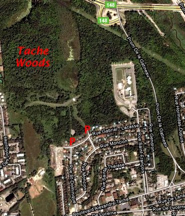 Google Satellite Map of Taché Gardens Woods
Site Description and Birding Information: Trails through deciduous woodland. Good in migration.
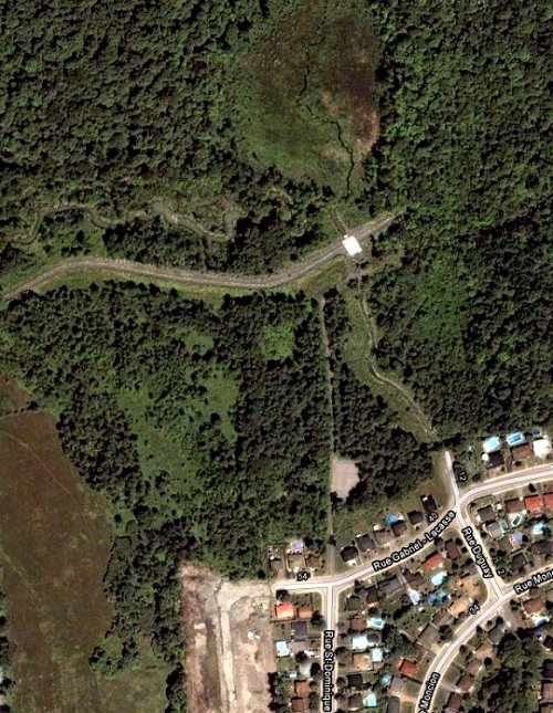 Google Satellite View of Taché Gardens Woods
Ottawa River West: Quebec Route Directions: From Taché Gardens Woods, return south the 0.4 km on Rue St.-Dominique to Boul. Taché. Turn left or east on Taché and go 0.5 km to Rue Boudria. Turn right or south on Boudria and proceed 0.1 km to Rue Brunet. Turn right or west on Brunet and proceed 1.5 km to Place Samuel-de-Champlain and the base of the Champlain Bridge, our next site on this route. Go directly across the junction and proceed 0.1 km along Boulevard de Lucerne. Turn left or southeast into the NCC's Samuel-de-Champlain parking lot.
Return to Ottawa River West: Quebec.
Return to Birding Ottawa Table of Contents.
|