Independent Directions to this Site: From Boulevard des Allumettières or Highway 148, take the Chemin Eardley exit in Aylmer. Turn right or northwest onto Chemin Eardley or the continuation of Highway 148 and proceed 11.8 km northwest on Eardley to Chemin de la Rivière, between Breckenridge and Heyworth. Turn left or west onto it. Follow this country road west through farmland and across the former rail line. Continue following it as it bends around to the northwest, following the old rail bed and bending again to the north, where it crosses the tracks again, just before descending to the creek. Park here, 2.3 km from Hwy 148.
Ottawa River West: Quebec Route Directions: From were you are parked at the old railway station in Breckenridge, turn left or northwest on Chemin Eardley or Highway 148. Proceed 1.2 km northwest on Eardley to Chemin de la Rivière, between Breckenridge and Heyworth. Turn left or west onto it. Follow this country road west through farmland and across the former rail line. Continue following it as it bends around to the northwest, following the old rail bed and bending again to the north, where it crosses the tracks again, just before descending to the creek. Park here, 2.3 km from Hwy 148.
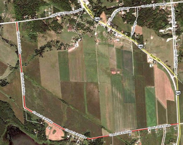
Site Description and Birding Information: This vantage gives you a view of what was the Ottawa area's most regular breeding site for Red-headed Woodpecker. The tall dead trees to the east are their nesting area. Unfortunately, reports of these birds have not been forthcoming in the last few years.

Near where you have parked, a path follows the old rail bed to the creek. The railway bridge across the creek to the west had a small colony of Rough-winged Swallows before it was removed. The farmland on either side of this area is excellent for Bobolink, Eastern Meadowlark, Northern Harrier, Horned Lark and other field birds. Eastern Bluebird is found here. The woods where the creek crosses the road and the pasture on the east side are good for a variety of birds, including Brown Thrasher and Northern Oriole. Northern Mockingbird was seen singing there in breeding season. Upland Sandpipers have been seen and heard in the fields to the east. During the invasion winter of 2004 - 05, a Great Gray Owl was seen here on Mar. 25 and 26. In the winter of 2010-11 one spent much of its time near the corner of Chemin des Pères Dominicains and Chemin de la Rivière (Dec. 19 to at least Mar. 12). A Gyrfalcon was seen nearby, at Highway 148 and Chemin Cregheur, on Jan. 22, 2006. In Feb. 2007, 2 or 3 Short-eared Owls were seen on Chemin de la Rivière at dusk hunting the fields from near Highway 148 all the way along to the old rail crossing near the creek.
Ottawa River West: Quebec Route Directions: From were you are parked at the old rail crossing on Chemin de la Rivière, go north 1.1 km to Chemin des Pères Dominicains. Turn left or west on Pères Dominicains and proceed 1.1 km to Chemin de la Sapinière. Turn left or south and enter the next site on this route, Chemin de la Sapinière.