BREWERY CREEK
Spring: ** Summer: * Fall: ** Winter: *
Independent Directions to this Site: From where Autoroute l'Outaouais or Highway 50 crosses over Autoroute de la Gatineau or Highway 5, the two major roads converging on Hull, continue on Hwy 50 south 1.3 km to Rue Montcalm. Turn left or southwest on Montcalm and follow it for 0.8 km to Boulevard Alexandre-Taché. Either park before reaching Taché or turn right or west on Taché and park near the bridge over Brewery Creek which is 0.1 km from Montcalm. Avoid downtown areas during rushhour!
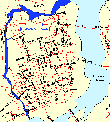 Map of Brewery Creek & Hull
Ottawa River West: Quebec Route Directions: To reach the first site in this route from where Autoroute l'Outaouais or Highway 50 crosses over Autoroute de la Gatineau or Highway 5, the two major roads converging on Hull, continue on Hwy 50 south 1.3 km to Rue Montcalm. Turn left or southwest on Montcalm and follow it for 0.8 km to Boulevard Alexandre-Taché. Either park before reaching Taché or turn right or west on Taché and park near the bridge over Brewery Creek which is 0.1 km from Montcalm. Avoid downtown areas during rushhour!
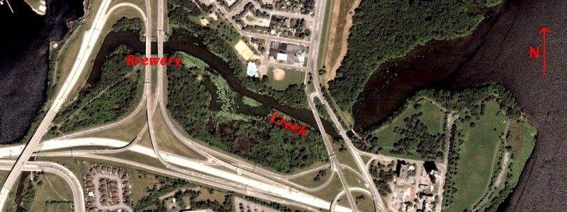 Google Satellite View of the Northern Portion of Brewery Creek
|
|
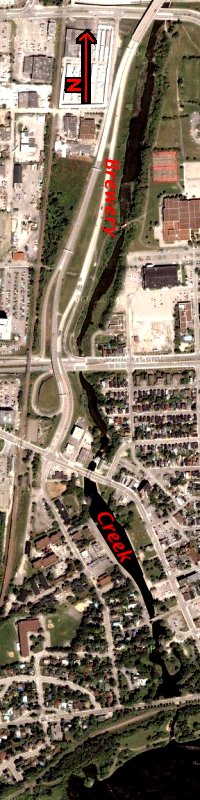 Google Satellite View of the Southern Portion of Brewery Creek
|
Site Description and Birding Information: Before starting a route on this side of the Ottawa River, it is wise to check the bird line of Le club des ornithologues de l'Outaouais (COO) at 819-778-0737.
Look back at the large, red-brick building to the northeast, the Terrasses de la Chaudière. The tower portion of this building is the favorite perch in Hull of Peregrine Falcons, but not as well frequented as the Coats Building or the Crowne Plaza Hotel, the latter a breeding site. But a good place to look for one for your Quebec list.
Brewery Creek, or Ruisseau de la Brasserie, is one of the most famous birding spots in the Ottawa area, historically. This is because of the 1940 book The Birds of Brewery Creek, which you can find in several local book dealer's shops. Sixty years of urban expansion has detroyed much of its potential, but it is still interesting. Brewery Creek is around 4 kilometres long and is really a section of the Ottawa River forming an "island" (Île de Hull).
It begins near where you are parked and continues north to just beyond where Autoroute l'Outaouais or Highway 50 crosses over Autoroute de la Gatineau or Highway 5, then it continues east to the Ottawa River again just below the MacDonald-Cartier Bridge and adjacent the Lac Leamy Ecological Park. In winter the kilometre north of Rue Montcalm is used by a large flock of ducks. Of course, if you don't wish to do it all on foot, you can find several access points along its course on either side of the creek. Highways 50 and 5 prevent direct access along some portions.
Ottawa River West: Quebec Route Directions: To visit our next site on this route, Hull to Val Tétreau, just stay parked where you are and follow the bike path on the river side of Taché to the west of the mouth of Brewery Creek, starting at Parc des Portageurs.
Return to Ottawa River West: Quebec.
Return to Birding Ottawa Table of Contents.
|
|
|